Geoscience Reference
In-Depth Information
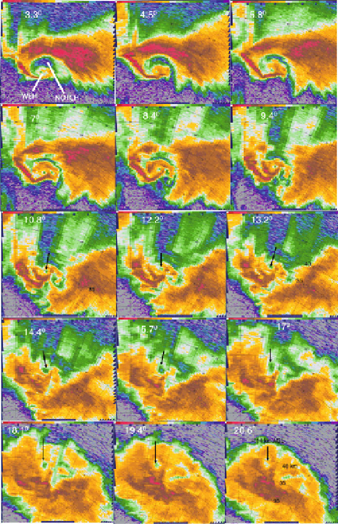
Figure 6.51b. As for Figure 6.51a. Series of horizontal slices of radar reflectivity at various
elevation angles (denoted in
) through the storm. Arrows point to the WEC at selected
elevation angles to aid visualizing vertical continuity. Range from radar given in km. At the
20.6
elevation-angle scan, the WEC is still evident at 14 km ARL.
Search WWH ::

Custom Search