Geoscience Reference
In-Depth Information
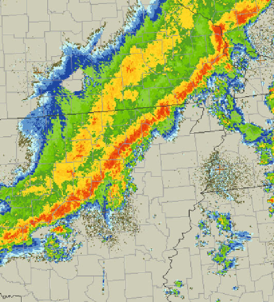
Figure 5.2. Example of a squall line with a leading convective line and a trailing stratiform
precipitation area on March 31, 2008 over Arkansas, as seen by WSR-88D radars. Radar
reflectivity factor is color-coded such that the warmest colors represent the most intense
precipitation.
(
Figure 5.5
). Bores may be triggered when an outflow boundary from prior con-
vection propagates into a stable air mass. So, when a bore or solitary waves or
internal gravity waves trigger a squall line, the squall line may actually be the
result of a secondary formation process (one that depends upon an earlier squall
line).
Broken areal and embedded areal mechanisms involve pre-existing convective
cells or pre-existing stratiform precipitation. In the latter case they probably
involve convection that is not based at or near the surface in the boundary layer,
but rather convection that is ''elevated''. The term ''elevated'' convection is used in
sharp distinction from boundary-layer based convection. Elevated convection is
sometimes referred to as ''high-based convection'', but is probably not a good
name since the boundary layer may be very deep and dry. The air that flows into
the cloud base during elevated convection has a recent origin above the boundary
layer. Elevated convection is more dicult to study because it often occurs when a
layer of air is lifted on the mesoscale, such that low, stratiform clouds often hide
convective clouds occurring above; in the case of boundary-layer based convec-
Search WWH ::

Custom Search