Geoscience Reference
In-Depth Information
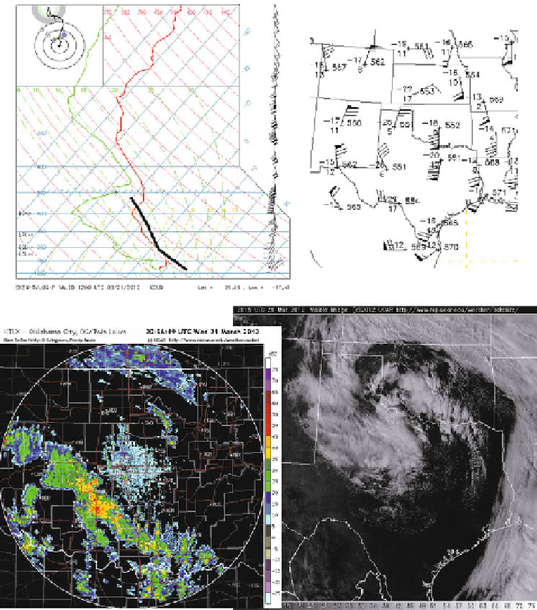
Figure 4.49. An example of convective storms that produced funnel clouds near a cold, upper-
level low on March 21, 2012 in Oklahoma. Some funnel clouds may have been associated with
convective storms having relatively low tops in an environment of low CAPE, but strong
vertical shear in the cloud-bearing layer. These storms may have been mini- or low-topped
supercells. (Top left) Sounding at 12:00
utc
at Norman, OK. Solid black lines show the path
taken by a surface-based air parcel if lifted to its LCL and LFC: it would rise in the presence of
small CAPE until its equilibrium level (only 550 hPa), but would experience strong vertical
shear. (Top right) 500 hPa plotted data at 12:00
utc
in the Southern Plains. The center of the
cold-core low is near southwestern Oklahoma and northwest Texas. (Bottom left) Radar
reflectivity factor from the WSR-88D Doppler radar at Oklahoma City, OK at about
21:00
utc
. (Bottom right) Visible satellite image covering the Southern Plains.
Search WWH ::

Custom Search