Geoscience Reference
In-Depth Information
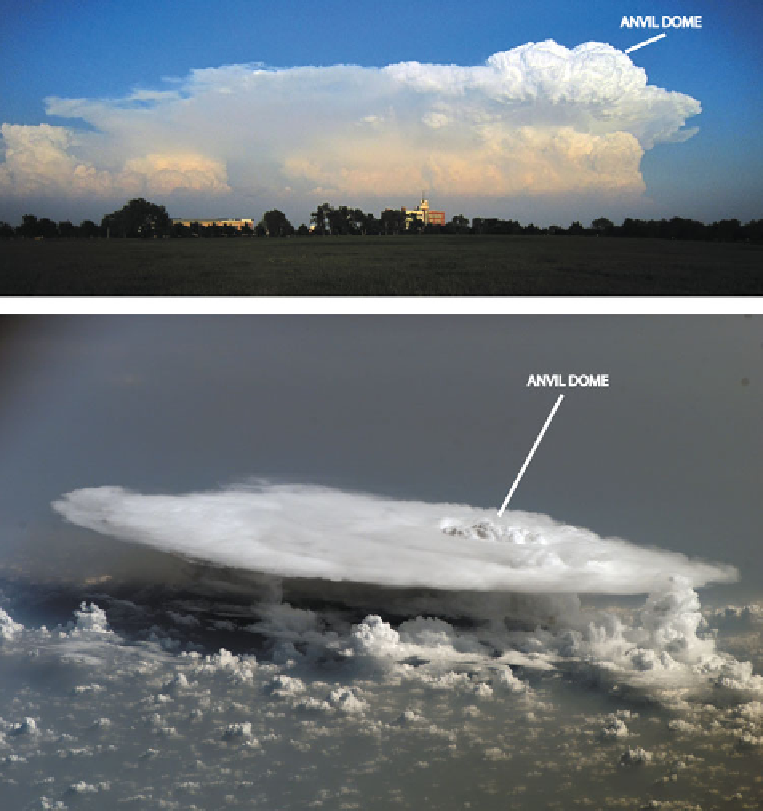
Figure 3.7. Anvil dome (penetrating top) at the top of a convective storm. (top) Tornadic
supercell southeast of the National Weather Center, Norman, OK, May 21, 2011 (photograph
by the author); (bottom) convective storm viewed from above by International Space Station
on February 5, 2008, over Mali in western Africa (from NASA).
There have been many studies using satellite imagery at various wavelengths
to detect penetrating tops and to determine when they grow and when they decay.
The main motivation for these studies is to use satellite imagery alone to infer the
likelihood of severe weather at the surface, hidden from visual view of the satellite:
it is assumed that the stronger the updraft, the deeper the penetration of the cloud
above the tropopause and the more likely there will be severe weather below.
Rings or horseshoe-shaped (''cold U/V or enhanced V'') regions of relatively cold
Search WWH ::

Custom Search