Geoscience Reference
In-Depth Information
A glacier classification system was introduced by UNESCO in
1970
as a contri-
bution to the International Hydrological Decade. This system gives a classification
scheme for perennial snow and ice masses. The aim was to provide a useful data-
base of glacial observations in a standardized digital form. The system was designed
to characterize the morphology of glaciers quickly and precisely (Rau et al.
2005
).
The development of such remote sensing techniques greatly improved the capa-
bility of observing glaciers in detail, and in this context, the Global Land Ice
Measurements from Space (GLIMS) program was developed, which is the creation
of a worldwide glacier inventory by means of satellite imagery (Rau et al.
2005
).
6.3 Background
6.3.1 Glacier Inventory, State of the Art and Applications
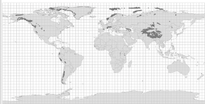
Globally, much work has been undertaken on glacier inventories, which include
inventories for the: Swiss Alps (Kääb et al.
2002
); Former USSR (Suslov
1978
);
Antarctic Peninsula (Braun et al.
2008
; Vaughan et al.
2003
); Alaska and Canada
(Young and Ommanney
1984
; Miller
1965
); and the Patagonian Ice fields (Aniya
1998
; Aniya et al.
1999
; Casassa et al.
2000
; Casassa et al.
2002
; Rignot
2003
;
Rivera and Casassa
2004
)(seeFig.
6.1
). Despite these important advances, there
still are three important needs for glacier inventory development:
1.
More detailed scale glacier inventories:
Generally, inventories which record
glaciers at a continent or country scale do not provide high spatial resolution
data because of resource availability (for example people, data, and support). In
Fig. 6.1
World coverage of World Glacier Inventory