Geoscience Reference
In-Depth Information
approximately 50 compounds in wastewater influent, effluent and biosolids that are
classified as caffeine, antibiotics, anti-depressants, and other pharmaceuticals, etc.
(Spongberg and Witter
2008
;Wuetal.
2008a
,
b
;Wuetal.
2009a
,
b
). Samples were
analyzed for PPCPs within a GIS and PPCPs were detected on the sludge amended
fields, from water exiting tile drains and in ditches downstream of applied fields (Wu
et al.
2009a
). We have determined the source of
E. coli
bacteria in runoff water from
biosolids applied fields using DNA sequencing (Kassem et al.
2008
; Esseili et al.
2008
). Remote sensing has been used to identify biosolids application from satel-
lite imagery as well as to estimate phosphorus concentrations in biosolids applied
soils (Sridhar et al.
2009
). Aerosol sampling has been performed using both direct
reading instruments and integrated sampling in an effort to characterize farm fields
during major field activities including application of biosolids. We are developing a
predictive screening model to determine the concentration and risk due to aerosols
released into the air on nearby residents.
This project led to the publication of an epidemiological study conducted in
Wood County of people living near agricultural fields permitted to receive biosolids
(Khuder et al.
2007
). The GIS described herein was developed in ArcGIS in support
of the Khuder et al. (
2007
) epidemiological study.
10.4.1 GIS Layer Development
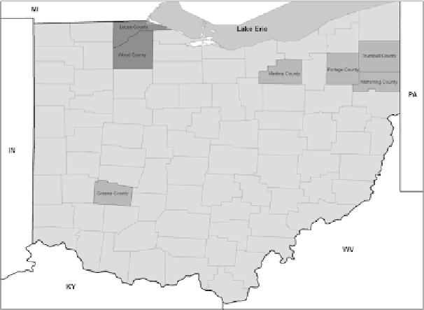
GIS databases were created for Lucas, Wood, Greene, Mahoning, Portage and
Trumbull Counties in Ohio (Fig.
10.2
). A standardized state plane, Ohio North
Fig. 10.2
Counties in Ohio in which the GIS and epidemiological surveys have been developed
and performed