Geoscience Reference
In-Depth Information
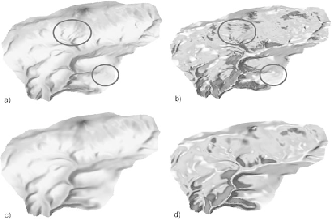
Fig. 14.2
DEMs created using the different settings of spline with tension method (a, c) and grids
of slopes derived from these DEMs (b, d)
14.2.1 Methods of Assessment of DEM Quality
The quality of the resulting DEM can be influenced primarily by a suitable selec-
tion of the type of source data, scale, relief expression (2D or 3D), DEM type and
interpolation method.
There are several methods that can be used for determining the inaccuracies in
the DEM. A quicker but less accurate way to detect all errors is a visual check of
the DEM (Fig. 14.3a, b). By this we can identify clearly visible traces in case of
insufficient vertical resolution and problems with terrain edges or local anomalies
(Gallant & Wilson, 2000). However, there are more objective methods compar-
ing DEMs containing assumed errors with reference data using statistical methods.
Among the basic means of comparison are standard deviation, average, minimum
and maximum values; the more advanced ones include RMSE (root mean square
error) calculation, hammock plot or calculation of hammock index. These meth-
ods can be used especially for the grid-type DEMs, which thanks to their structure
enter the process of modelling various physical geographic phenomena much more
often.
The most commonly used degree of inaccuracy is the
root
mean square error -
RMSE. It measures the spread of division of the frequency of deviations between
the original altimetric data and the DEM data. Mathematically it is expressed in the
following way (Wechsler, 1999):
Search WWH ::

Custom Search