Geoscience Reference
In-Depth Information
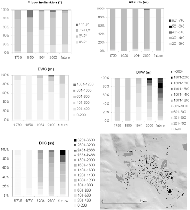
Fig. 11.1
Dependence of territorial growth of the town on various conditions/factors. In the
right-
hand bottom
corner - initial GRID layer of territorial growth of Klášterec nad Ohrí (see text for
explanation of abbreviations)
(Oršulák et al., 2007; Raška, Oršulák, Andel, & Balej, 2007), which are focused
on creation of so-called hyperdata, i.e. multi-temporal data of various nature (ana-
logue and digital map sources, image and statistic documentary sources etc.) and
their processing, mutual correction and increased reliability and validity.
For the purposes of interpretation, data were visualised in a form of 2D maps
in the ArcMap environment from ESRI. The resulting alternative scenarios of the
future landscape and historic reconstructions were loaded on the TIN structure cre-
ated from the altitude element of the digital model of the territory (DMU 25),
which was updated and made more accurate by GPS measurement. To get an idea
of the development of the settlement structure, a reverse reconstruction was used
(Fig. 11.2). In the first stage, a 2D model of the existing development was prepared
on the basis of ortho-photographs and field surveying. With the use of the his-
toric data, the newer development was excluded gradually starting from the present
Search WWH ::

Custom Search