Geoscience Reference
In-Depth Information
4
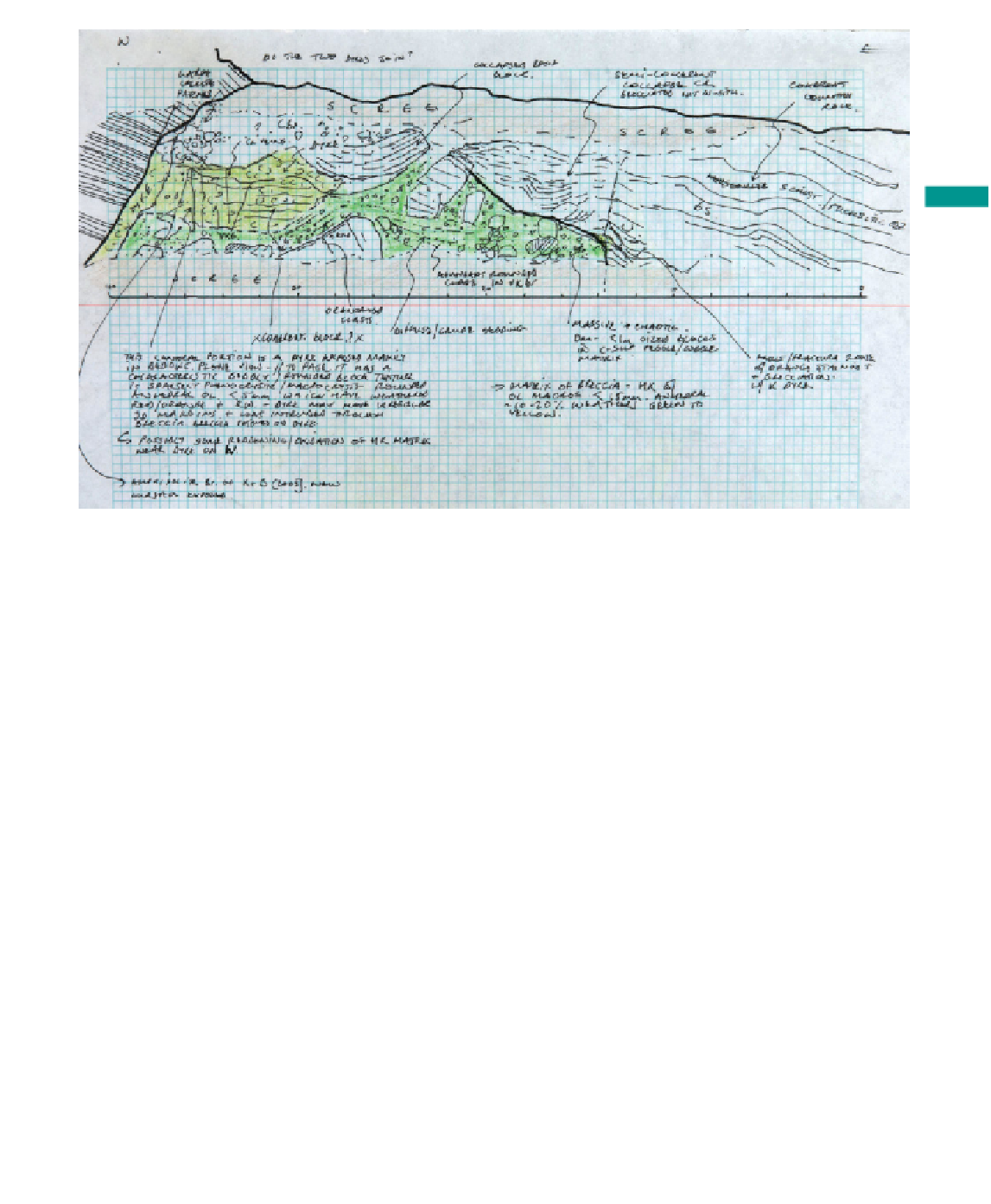
Figure 4.7
Detailed sketch of part of a kimberlite complex, South Africa illustrating use of an accurate
horizontal scale in addition to good use of colour, clear labelling that does not interfere with the sketch and
distinct boundaries between the different units. (Notebook of Richard Brown, The Open University, UK.)
•
Use different line weights to distinguish between distinct
and gradational boundaries. Use shading to pick out darker
coloured units.
•
Do not try and draw the three-dimensional nature of the
face (e.g. Figure 4.3e, p. 60). This will make it very
complex. Imagine instead that the beds are projected onto a
fl at plane (Section 4.3.3). If necessary draw a sketch map to
relate different two-dimensional faces to each other.
•
If the sketch is to cover a laterally extensive area add a
horizontal scale and consider breaking the sketch into
scaled panels (Figure 4.7).
4.3.3 Sketching metre- and
centimetre-scale features
All geological features occur in three dimensions, whether
they are due to rock deformation, sedimentary processes or
intrusion processes. Whilst a small minority of people are
capable of drawing clearly in three dimensions, most of us
are not. For some features such as faults and bedding a
two-dimensional representation is suffi cient.