Geoscience Reference
In-Depth Information
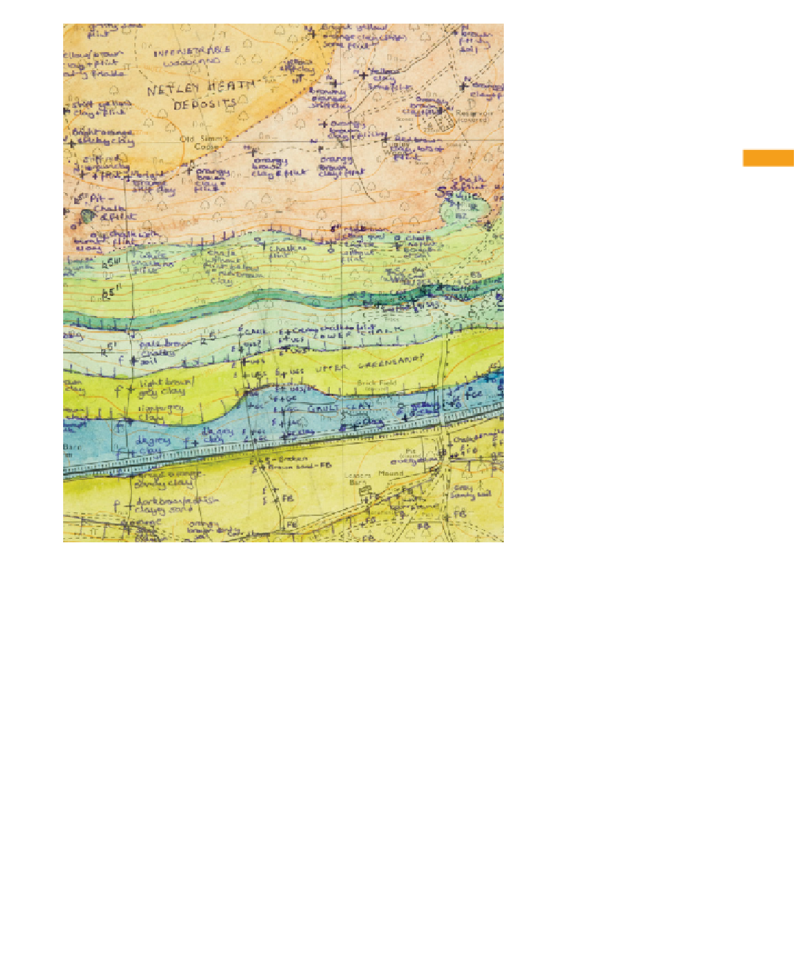
10
Figure 10.18
Field map in an
area of poor exposure, with
annotations on auger borings of
the shallow subsurface augmented
by notes on breaks in slope. Most
boundaries are dashed or dotted
(inferred). Auger holes are marked
with a plus symbol (+); actual
exposures are marked with a star
(
*
); letters refer to notebook
entries. (Map of Kate J. Andrew,
Herefordshire Heritage Service,
UK.)
10.6 The geological map
This section will discuss how to proceed from fi eld maps and
notebook information through to producing the fi nal fair copy
map, along with additional interpretative material such as
cross-sections.
10.6.1 Inking in the fi eld map
It is advisable to 'ink-in' fi eld maps as soon as possible after
mapping (e.g. in the evening). The aim is not to create a neat
'fi nal map', but to review your observations and evidence while
they are fresh in your mind, resolve any discrepancies, and then