Geoscience Reference
In-Depth Information
N
50 km
8
(
(
N
50 km
N
1 km
1
0 km
(
(
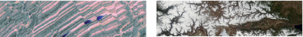
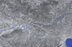
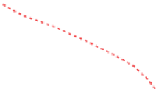
Figure 8.1
(a) Perspective view of a gently-dipping thrust plane (arrowed contact between dark strata in
hanging wall and pale strata in the footwall) which follows topographic contours: Keystone thrust, Nevada, USA.
Distance between arrows is about 20 km. (b) A major strike-slip fault (arrowed) cuts across topography in this
image showing relief on the South Island of New Zealand, generated using radar from the Space Shuttle.
(c) Steep faults offsetting tilted strata in this satellite image, southern Pakistan. (d) River valleys aligned along
faults (dashed red lines) in this satellite image near Lake Baikal, Russia. Inset is a modifi ed Landsat image that
highlights the pronounced offset of a river (blue) across a strike-slip fault (dashed red lines). (a: Generated from
U.S. Geological Survey Landsat image and National Elevation Dataset; b and c: courtesy of the U.S. Geological
Survey /NASA images; d: Modifi ed from U.S. Geological Survey / NASA MODIS and Landsat images.)
irregular or inaccessible the orientation may have to be
estimated by sighting along the plane with a compass (Figure
8.3b, p. 168). If only the edge of the plane can be seen the
recorded dip will be an apparent dip, lower than the true dip
by an amount that depends on how inaccurate the strike
estimate is. If possible, it is worth carefully excavating a small
portion of the slip plane to measure.
With increasing depth, faults tend to widen into zones with
multiple fractures, and then breccia or fault gouge zones
contained within bounding surfaces (Figure 8.3c). Minor
fractures within these fault zones may seem chaotic, but their