Geoscience Reference
In-Depth Information
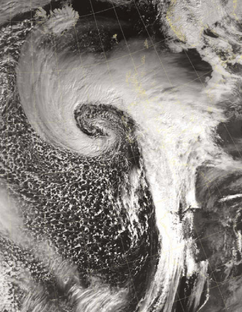
Plate 4.9
A classic cloud system spiralling around low pressure centred to the west of Scotland. The cold front marks the
boundary between the stratiform cloud of the warm sector and convection in the cold air behind. The margins of the warm front
to the north and east of Scotland are more diffuse, being formed of cirrus cloud, gradually thickening as the surface warm front
approaches. Note the decrease in cloud thickness along the line of the cold front away from the centre of the low.
Image: Courtesy of the Satellite Receiving Station, University of Dundee, and NOAA
evaporating; drops of 100 μm and 1 mm would fall 150 m
and 40 km respectively. Despite the relatively small size
of the raindrops, the areas affected by rising air are vast.
For a particular rain belt, it may take several hours of
steady rain before the system has passed, giving a total fall
of perhaps between 5 mm and 10 mm. An example of
rainfall from a cyclone is shown in
Figure 7.11
.
In the deep
and widespread clouds associated with low-pressure
systems it is quite common for ice-crystal clouds at higher
levels to act as a source of supply to the mixed clouds of
ice and water droplets at lower levels - a process known
as
seeding
. The addition of extra ice crystals speeds up the