Geoscience Reference
In-Depth Information
20 per cent by
AD
2100, leading to extensive drying and
dryland-desert expansion across the Sahel, Mediter-
ranean, south-western Asia and southern Africa in
particular. Hot-weather extremes and heatwaves are also
very likely to become more frequent during climate
disturbance in many regions, even where net precipitation
increases. Initial hydrogeomorphic consequences are likely
to be suppressed, and many lakes will shrink or disappear
altogether. However, reductions in vegetation cover and
adverse land management practices, especially in less
developed regions, will lead eventually to increased fluvial
and aeolian erosion, higher sediment yields and channel
destabilization. Soil and water salinization is an additional
risk in areas already experiencing desiccation and stress
on agricultural land (
Plate 28.4
),
with wildfire frequency
and intensity, already increasing in mid/high-latitude
continental forests and peatlands, also strongly sensitive
to the same climate changes and associated land use
practices.
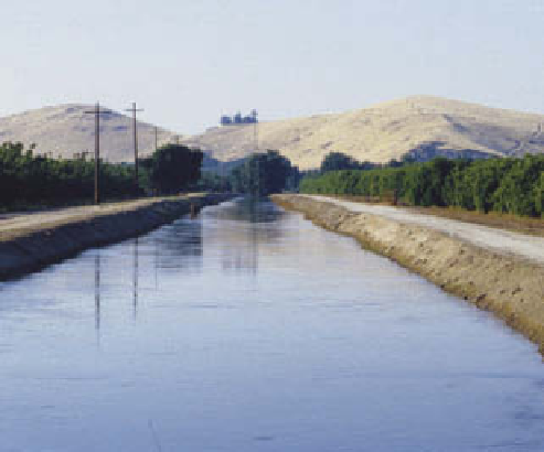
Plate 28.4
Irrigation canal leading over-allocated Sierra
Joaquin valley, Central Valley, California.
Photo: Ken Addison
Coasts
The immediate geomorphic impact of sea-level rise is to
increase the extent and frequency of coastal flooding. It
is quickly appreciated that this becomes exacerbated by
non-linear 'multiplier effects' associated with elevated
SSTs driving increasing maritime storm intensity and,
hence, higher storm surges. Flood risks are highest in
low-lying estuarine, delta and lagoon coastlines where
heavy precipitation during intense storms also increases
land-based run-off. Net coastal erosion is the most likely
consequence of these climate-driven changes. Barrier
beaches and dunes will be overtopped more frequently
and their adaptive capacity will depend on local net
sediment transfers and budgets (see
Figure 17.8
)
and -
especially - their ability to migrate inland. The latter is
ultimately restricted by natural backshore or inland
barriers, sediment starvation and, more likely, structures
defending human interests in the hinterland. For similar
reasons, salt marshes and mangroves, which provide
natural protection against wave damage, are expected to
experience substantial and increasing loss, currently
less obvious loss of protection is appearing in the Arctic
basin, where increasing seasonal loss or disintegration of
sea ice is exposing the coastline to wave and storm damage
for the first time. Even rocky coastlines cannot expect to
avoid all impact from sea-level rise and higher storm-wave
intensities, although this is likely to be restricted initially
to cliffs and marine platforms already close to failure
threshold conditions.
part of 7,000 km of the Atlantic and Gulf Coast of the United
States seriously challenged by rising sea level.
Photo: Ken Addison
Unfortunately for both sides, natural processes and
human occupation of the coastline will come into
increasing conflict in future centuries as sea levels rise,
global population increases and the many socio-economic
advantages of coastlines continue to attract coastward
migration. IPCC predicts, with very high confidence
(
90 per cent likelihood), that the global population
living at the coastline will increase from 1.2 billion today