Geoscience Reference
In-Depth Information
Cirque (by name)
Marchlyn Marchlyn Ceunant
Cl
^
d
Graianog Perfedd
Bual
Coch
Cywion
Idwal
Cneifion
Bochlwyd Tryfan
Gwern
Y Gors
Bach
Mawr
Gof
Reconstructed
654
756
*
630
610
670
670
670
690
810
630
790
*
802
*
746
*
668
538
equilibrium-line
altitude (m OD)
ri tati n
8 2 0 2 1 9 0 8 3 8 0 5 0 1 3
(° from north)
Excavated
0.26
0.66
0.19
0.47
0.56
0.47
0.38
0.60
0.55
1.37
0.47
1.09
1.01
1.05
0.75
Area (km
2
)
Maximum rock-
190
190
130
200
170
170
170
220
230
420
230
230
220
180
240
wall height (m)
Elongation
0.68
1.64
1.73
1.65
1.40
1.95
1.66
1.28
1.52
1.94
2.09
1.74
1.37
1.47
1.62
Length : breadth
ratio
Notes: Mean values: equilibrium line
* 7
80 m; remainder 645 m; orientation 44
o
(compass 044
o
); elongation 1.58.
D
6QRZGRQQXQDWDN
/OLZHGG
&ULE*RFK
<U:\GGID
&DUQHGG8JDLQ
3UHJODFLDOFROVLWH
0HULRQHWK
LFHFDS
/ODQEHULV
RXWOHW
JODFLHU
7UDQVIOXHQWLFHVWUHDP
7UHJDODQ
*ODVO\Q
8*ODVO\Q
&ORJZ\Q
*ODV
'XU$UGGX
E
/O\GDZ
*ODV%DFK
*ODV0DZU5HVHFWLRQ
8FKDI
1DPHVLQGLFDWHFLUTXHJODFLHUV
%ZOFK&LOLDX
%ZOFK0DLQ
*ODVO\Q
3ODWHDXUHPQDQWV
F
/O\Q*Z\QDQW
1DQW3HULV
1DQW
*Z\QDQW
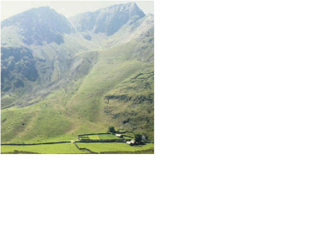
range above Nant Ffrancon, crowned by the summit of Foel
Goch (831 m OD), showing strong structural and subsidiary
palaeoclimate control like its neighbours. Two prominent
moraines of Late Devensian age lie below the exit to the
glacially excavated rock basin and above a fan derived from
their erosion. Wetland vegetation in the valley floor marks the
Photo: Ken Addison
/O\Q/O\GDZ
1DQW*ZU\G
0RGHUQFRO
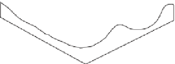
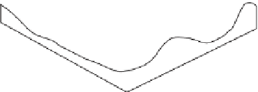
Snowdon, showing the probable appearance of glaciers at (a)
Late Devensian maximum (c. 18 ka
BP
), (b) Loch Lomond
Advance (c.12 ka
BP
) and (c) at the present time.
Source: Addison (1999)