Geoscience Reference
In-Depth Information
(a)
the river Severn, where it is constricted through Ironbridge
Gorge, Shropshire. The section is 3 m wide.
Photo: Ken Addison
(b)
Breaking wave
antidunes
Antidunes
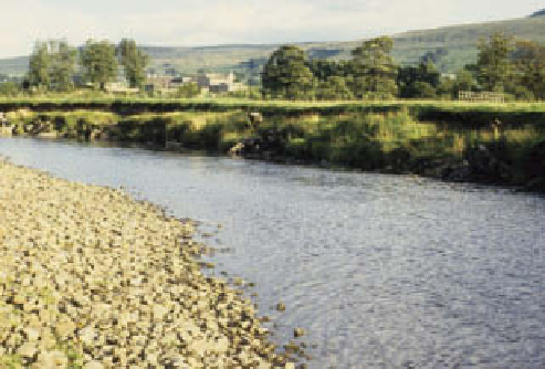
Plate 14.8
Two stages in fluvial channel development on the
river Wharfe in the Yorkshire Dales. Bank caving has been
stabilized by vegetation growth in (a), compared with the
Photos: Ken Addison
Standing wave
antidunes
Plane bed
ripples. These are planed off where
F
approaches 1 and
antidunes form where
F
is more than 1, this time in phase
with surface waves (
Figure 14.15
).
Channels are clearly dynamic landforms making
constant adjustments between form and function, to
which we return below. Continuing questions about the
way in which water flows, and carries out work, focus
appropriately on very small channel segments or con-
trolled laboratory flumes. For the purpose of summarizing
general impacts on the land surface and fluvial
landsystems, we need to appreciate the potential energy
available in each channel segment and the shear stress
mobilized at the channel boundary.
Stream power
,
measured in W m
-2
, is defined as:
Washed-out dunes
Dunes
Dunes, with
superimposed ripples
Ripples
Velocity
alluvial channels, channel roughness and stream flow
Source: After Selby (1993)
=
gQS