Geoscience Reference
In-Depth Information
and are identified by the principal displacement direction
(
Figure 12.23
).
Faults and joints are organized in geo-
metric (usually orthogonal) patterns and each plane is
defined by a
dip
and
strike
. They differ in scale, with joint
spacing at 10
1-3
cm and faults two or three orders of magni-
tude larger. Fractures may be 'clean breaks' or occasionally
smoothed, where movement has abraded opposing faces
to form
slickensides
. However, both forms may be lined
with a 'fill' composed of coarse rock fragments (
fault
breccia
), fine debris (
gouge
) or cement - which may be
weaker or stronger than the fractured rock mass itself.
Deformation accompanies both small-scale rock-
forming processes, when they are lithological in nature,
and the creation of large-scale tectonic structures.
Subsequent applied stresses are likely to be accommodated
along existing structures first and, in that way, Earth's
principal mobile belts often drive younger plate motions
and orogens. In addition to their primary function, they
are of vital importance to denudation (
Plate 12.13
).
(a)
(b)
CONCLUSION
We occupy the land surface of a living Earth and
contribute in a minor way to its rock cycle, by using and
discarding geological resources and interfering with the
energy flows and components of endogenetic processes.
Landscapes around us are strongly influenced by their
geological foundations and, armed with sufficient
knowledge and the right techniques, we are able to
reconstruct their palaeo-environmental history (see
Chapter 23)
. Long time scales should not deflect us from
the need to understand our geological environment and
heritage. Large human populations living along plate
boundaries are only too aware of how dramatically abrupt
geological events can be. Every stage of the rock cycle can
be located within the global mosaic of moving plates and
morphotectonic landforms, permitting a better
understanding of Earth's dynamic evolution and a better
assessment of geological resources and hazards.
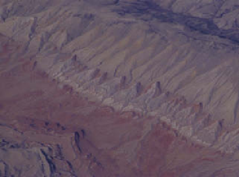
residual triangular flat-iron scarps on the flanks of an eroded
anticline in Rocky Mountain foothills, Montana, United States.
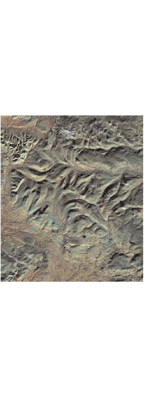
Tectonic structures control the geomorphology. (b) Western
Pennines, Northwest England. Carboniferous rocks from
upladnd areas of the Askrigg block, bounded on western and
southern margins by the NE-SW Dent Faults and NW-SE
Craven Faults repectively. Landsat Thermatic Mapper image
50 km wide, bands 4, 5 and 7.
Photo (a): Ken Addison; image (b): British Geological Survey.
X
1
X
1
X
1
X
1
X
1
X
1
Normal fault
Reverse or
thrust fault
Strike-slip or
wrench fault