Geoscience Reference
In-Depth Information
(a)
(b)
LONGITUDE
0
60°
120°
180°
120°
60°
0°
25°C
80°
80°
Warm current
1
Cold current
60°
60°
AAIW
2
40°
40°
20°
20°
AABW
3
N
0°
0°
20°
20°
AABW
4
40°
40°
5
60°
60°
80°
60°
40°
20°
0°
Latitude
20°
40°
60°
80°S
60°
120°
180°
120°
60°
0°
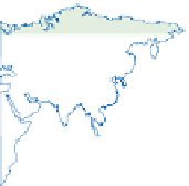
Figure 11.12
Thermohaline deep-water circulation or Global Ocean Conveyor: (a) principal global circulation, (b) vertical section
north-south through the Atlantic Ocean. See text for initials of stratified flows.
Source: In part after Gross (1990)
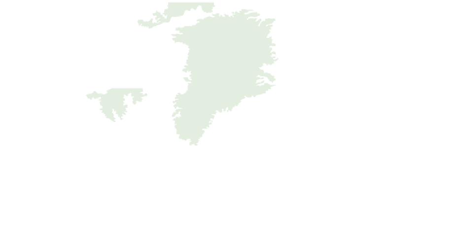
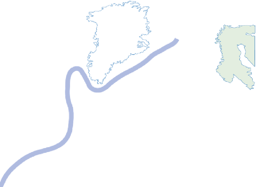
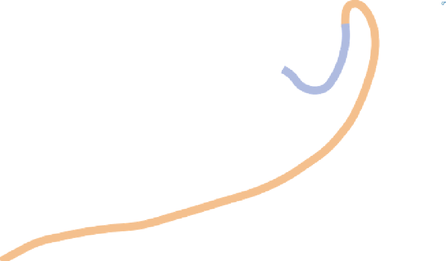
Svalbard
Greenland
Sea
Greenland
Ice
Cap
Baffin
Bay
Norwegian
Sea
Hudson
Bay
Iceland
North
Sea
Labrador
Sea
Newfoundland
New
York
Lisbon
0
1000
km
Mean limit of sea ice (winter)
Arctic Circle
Mean limit of sea ice (summer)
Surface, wind-driven warm currents
Sea ice and glaciers
North Atlantic Deep Water (cold currents)
Figure 11.13
The source areas and pathways of North Atlantic Deep Water and North Atlantic Drift (Gulf Stream) and their
impact on European climate. During the depths of the last global cold stage, 18 kyr ago, combined atmospheric and oceanic
re-create this condition.