Geoscience Reference
In-Depth Information
(a)
(b)
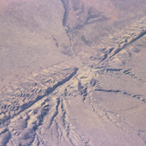
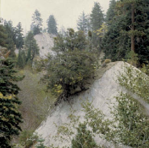
Plate 10.3
The San Andreas Fault in southern California. (a)
A grooved and ridged 6 km section of the fault crossing the
Carrizo Plain, north-west of Los Angeles, marks the boundary
of the North American (foreground) and Pacific (background)
to the right by the north-west movement of the Pacific plate.
(b) Rocks squeezed upwards to form paired reaction surfaces
on either side of the fault where it crosses the eastern San
Gabriel mountains. (c) The mobile nature of the fault zone is
reflected by vertical and disharmonically folded strata, particu-
larly in deformable desert gypsum, in this highway cutting
near Palmdale, western Mojave desert.
Photos: Ken Addison
(c)
Tibetan plateau is the most celebrated example, covering
over 2 M km
2
at a mean altitude of some 5 km and with
a crustal thickness of 70-80 km. It reached its present
height during the past 3-5 Ma and is instrumental in
Quaternary changes in global atmospheric circulation
and the south-east Asian monsoon. The Bolivian
Altiplano, 4 km in mean elevation over 0·4 M km
2
, and
the Colorado plateau (0·5 M km
2
and 1·9 km high) have
similar origins. Uplift of the latter triggered 2 km of
spectacular incision of the Grand Canyon by the Colorado
river, exposing 1 Ma of Earth history. Plateaux not
underlain by thick crustal lithosphere are elevated by
epeirogenesis. Occasionally one plate continues its
advance into another. The Indian continental subplate has
achieved this,
indenting
(penetrating) the Eurasian plate
by a further 2,000 km since initial collision
c
. 40 Ma ago
and continuing to promote
indentation tectonics
well
into Asia.