Geoscience Reference
In-Depth Information
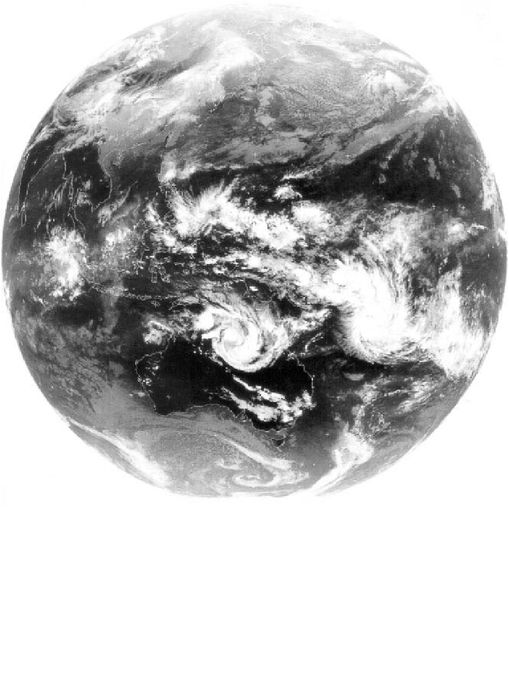
Plate 6.2
An infra-red waveband image of the cloud patterns on 27 February 2001 at 06.00 UTC. The enhanced cloudy zone of
the Equatorial Trough, slightly north of the equator, is clearly seen, though it does not form a continuous feature. To the south
over Australia and the south-west Pacific are two mature tropical cyclones and one in the process of formation. The warmer,
lower clouds of the subtropical north and south Pacific Ocean appear with a greyer tone. The spiral of cloud south of Tasmania is
part of the southern hemisphere westerly belt, with clouds spiralling in the opposite direction to those of the northern
hemisphere.
Image courtesy of the Satellite Receiving Station, University of Dundee, and EUMETSAT