Geoscience Reference
In-Depth Information
Chrono-
strat.
Depositional
Environment
CDP
GR-log
Amundsen Fm
0
Nansen Fm
S1
S2
100
S3
S4
200
S5
300
400
500
600
700
800
900
1000
020406080 100
CDP
Alke Fm
1100
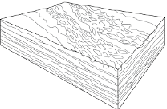
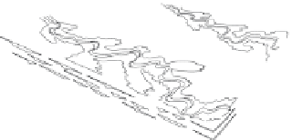
Rivers, lakes
Sand
Floodplain mud
Palaeosol horizons
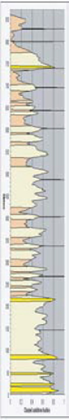
Fig. 3.
Stratigraphy of the Lunde Formation and the Statfjord Group in the Tampen Spur area, northern North Sea,
illustrated by a gamma-log from well 33/12-2, Statfjord Field, with true stratigraphic thickness in metres (m TST) and
channel deposit proportion (CDP). Allostratigraphic units (L12 to L01, S5 to S1) and informal subunits of the Lunde
Formation and the Statfjord Group as applied in this paper are shown together with stratigraphic intervals of fluvial
sandstone assemblages (FSA1 to 6), palaeosol assemblages (PA1 to 5), clay mineral assemblages (CMA1 to 5) and an overall
interpretation of the depositional environment (modified from Nystuen
et al
. 2008). The Nansen Formation is shallow-
marine and is overlain by the open-marine Amundsen Formation of the Dunlin Group. LLF = lower Lunde Formation,
MLF = middle Lunde Formation, ULF = upper Lunde Formation, LSG = lower Statfjord Group, USG = Upper Statfjord Group.
Depositional models: blue = rivers and lakes, yellow = sand, green = floodplain mud, red = palaeosol horizons. The lower
boundary of the Statfjord Group is according to Deegan & Scull (1977) and Vollset & Doré (1984) (2951 m below KB).


Search WWH ::

Custom Search