Geoscience Reference
In-Depth Information
Small sub-circular depression
Thick
2-14
Mound
Collapse
basin
5-1
Tr ench
Scallops
2-6
5-2
Thin
0
2 km
2-14
2-6
5-1
5-2
1900
2000
2100
SELE_FM
SELE_FM
SELE_FM
SELE_FM
LISTA_FM
2200
LISTA_FM
LISTA_FM
LISTA_FM
2300
0
2km
2-14
2-6
5-1
5-2
1900
2000
2100
2200
2300
0
2km
Balder Formation/Odin Member
Sele Formation/Hermod Member
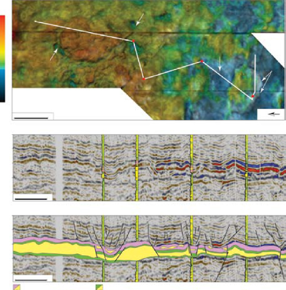
Fig. 14.
Large-scale sand remobilisation in the Frøy area, evident in the Sele Formation isochron map and seismic section.
The area can be divided into sand evacuation and sand injection zones. Faults that originate in the Hermod sand and ter-
minate in the Horda Formation clays can be observed locally at the boundaries between these two zones. These faults are
thought to have formed by roof collapse during sand evacuation. Hermod sand in well 25/5-1 appears to have been evacu-
ated to a mound and thereafter fed back into the overlying Balder Formation across a roof collapse fault that juxtaposed
Hermod to Balder.
INTERPRETATION
or steep-sided mounds hint at a generic relation-
ship and the most obvious interpretation is one of
lateral transportation of Hermod sand from the
depressions to the mounds which can have anom-
alously high net-to-gross sand content in the Sele
Formation (i.e. well 25/6-1; Fig. 15). The large size
of some discrete depressions or 'collapse basins'
The lack of Hermod Member in a small circular
depression drilled by well 25/5-1, within the
broader Hermod sand fairway (Fig. 2), suggests that
the depressions represent areas of post-depositional
sand evacuation. Their close association to ridges
Search WWH ::

Custom Search