Geoscience Reference
In-Depth Information
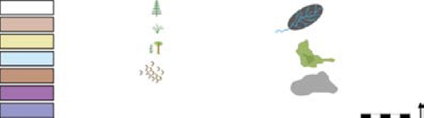
(A)
(B)
(C)
(D)
Halite
Upland vegetation
Calculated catchment
area (14800-69500 km
2
)
Playa muds
Fluvial sands
Shrubland vegetation
Marshland vegetation
Marsh
Marine carbonates
Aeolian deposits
Sabkha
Upland areas
Middle Carnian exorheic drainage (Stuttgart Formation)
N
200 km
Late Ladinian exorheic drainage (Erfurt Formation)
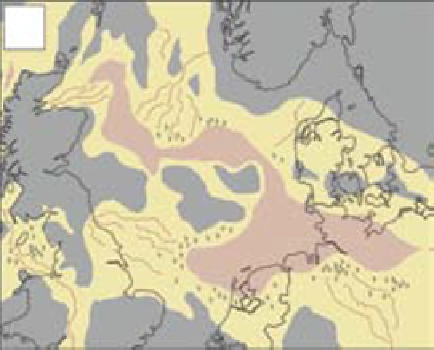
Fig. 19.
Palaeogeographic response to regional climate wettening. (A) Early Triassic basins were arid and characterised by
endorheic drainage which discharged into playa-dominated basin centres during pluvial phases. Aeolian reworking was
common on the distal fringes of the fluvial systems. (B) During Middle Triassic pluvial phases large terminal fluvial
drainage systems developed across the central North Sea, with widespread riparian vegetation cover. These may have
locally exited the central North Sea, but were still terminal in character. (C) During Middle Triassic arid phases fluvial
activity was reduced. Terminal fluvial systems contracted and playa expanded. However, the presence of the Muschelkalk
seaway may have elevated local humidity, allowing the maintenance of vegetation cover. (D) During major pluvial episodes
in the Late Ladinian and Middle Carnian fluvial systems formed an exorheic drainage towards Tethys, with rift flank uplift
potentially diverting Fennoscandian drainage away from the central North Sea and across the Southern Permian Basin
towards Tethys. The Southern Permian Basin became a site of fluvial incision as Erfurt Formation and Stuttgart Formation
rivers initially flowed towards a lower marine base level. The central North Sea record is fragmentary and may have been
entirely denudational during these episodes, but evidence from adjacent areas suggests that perennial lakes formed in
isolated, sand-starved, depocentres.


Search WWH ::

Custom Search