Geoscience Reference
In-Depth Information
FS
PS
FS
PS
FS
FACIES
ASSOCIATIONS:
Tidal sand ridges
A
B
C
Inter-ridge swale-fill deposits
FS - marine flooding surface
Wave-worked littoral deposits
PS - parasequence
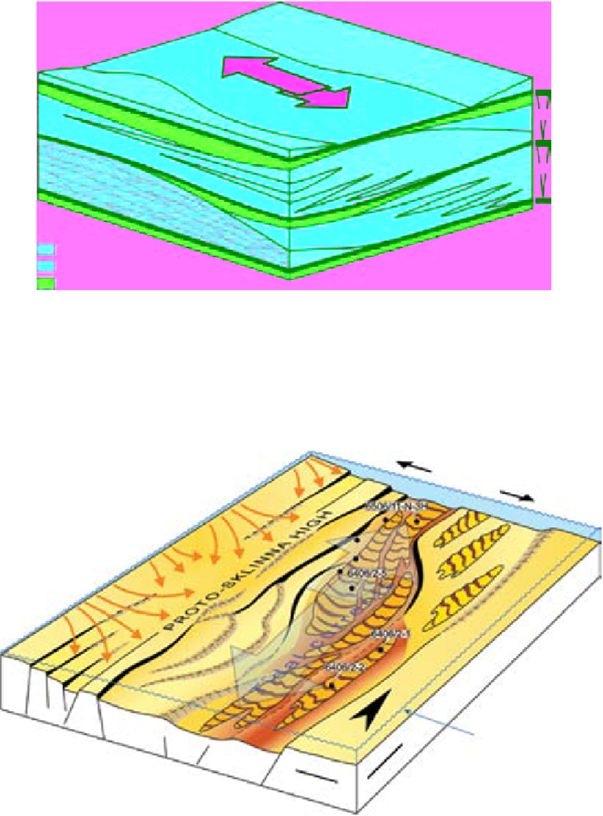
Fig. 10.
Schematic diagram showing the interpreted spatial relationships and stratigraphic organisation of the main facies
assemblages of the Garn Fm. in the Kristin Field (cf. Fig. 8); the vertical scale is grossly exaggerated for graphical purposes.
The diagram represents an approximate area of 2 km × 2 km and a stratigraphic thickness of 10 m to 15 m. Note that each
parasequence consists of the tide-dominated deposits A and B, covered with the wave-worked littoral deposits C or truncated
by a correlative equivalent surface of wave erosion.
Bathymetry
within wave-base
depth range
Fig. 11.
Hypothetical reconstruction of the incipient Kristin graben and its zones of greatest subsidence during deposition
of the Garn Fm. The elevated fault blocks west of the proto-Sklinna High subsequently collapsed during the climax of Late
Jurassic rifting (cf. Fig. 2B).
Search WWH ::

Custom Search