Geoscience Reference
In-Depth Information
Smørbukk
6506/11-2
6506/11-4
Smørbukk Fault
Trestakk-Smørbukk Fault
6406/2-3
Kristin
6406/2-5
(B)
NW
SE
WNW
ESE
6406/2-3
Wells 6406/2-3T2
6406/3-2
6407/1-2
6407/6-5
0.0
Garn Fm.
Ile & Tofte
fms.
Tilje Fm.
Åre Fm.
(with marker
coal level)
1.0
Bremstein Fault
Cenozoic
2.0
Trestakk-Smørbukk Fault
Cretaceous
Melke & Spekk fms.
3.0
Klakk Fault
BCU
Garn-time Kristin
graben
Top of Triassic
4.0
5.0
~10 km
Sklinna
High
Kristin
Trestakk Tyrihans South
Mikkel
6.0
Trøndelag
Platform
Halten Terrace
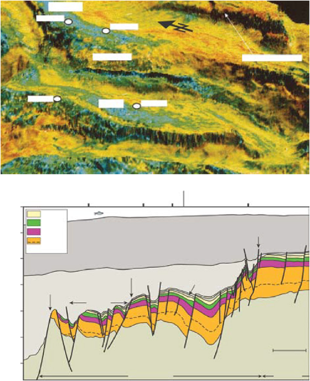
Fig. 2.
(A) An eastward perspective view of the Halten Terrace structural image draped with a seismic-reflection intensity
map of 48-ms window below the base-Cretaceous reflector, sampling the Upper Jurassic. The zones of low intensity (blue-
green colours) are attributed to the erosion of the Upper to Middle Jurassic (Corfield & Sharp, 2000). (B) Geoseismic cross-
section through the Halten Terrace along the traverse line shown in Fig. 1 (left-hand map), with the BCU symbol denoting
the base-Cretaceous regional unconformity (modified from Martinius
et al
., 2005).
Search WWH ::

Custom Search