Geoscience Reference
In-Depth Information
Erskine
Elgin
Franklin
Shearwater
Gannet
Clyde
Fulmar
Kittiwake
Cod
Ula
Gyda
Seismic Horizons
Green
BCU Seis surf.
K10 “Stenomphalus” MFS
130
J76 “Kochi” MFS
J74 “Preplicomphalus” MFS
J73 “Anguiformis” MFS
J72 “Okusensis” MFS
J71 “Fittoni” MFS
J66 “Hudlestonei” MFS
Purple (SJU600)
“Gyda Sst” of Gyda Field
J64 “A utissiodorensis” MFS
Ribble Sst of Fulmar Field
Orange
140
J63 Seis Surf (onlap)
J63 “Eudoxus” MFS
Kimmeridge Clay Fm
Fulmar Sst of Fulmar Field
Freshney Sst of Jacqui
Yellow
(SJU400)
J62 “Baylei” MFS
J56 “Rosenkrantzi” MFS
J54b “Serratum” MFS
J54a “Glosense” MFS
Top J50 Seismic surface
Healther Fm
Blue (SJU350)
Franklin C Sst
Franklin B Sst
Franklin A Sst
Shearwater
Elgin & Franklin fields
“Basal Sst” of Gyda Field
150
J52 “Densiplicatum” MFS
Top Bryne/Pentalnd Seismic surface
Brown (SJU300)
Max. Flooding Surface
Sequence Boundary
Shoreface sandstone
Shelf/Basin mudstone
Turbidite sandstone
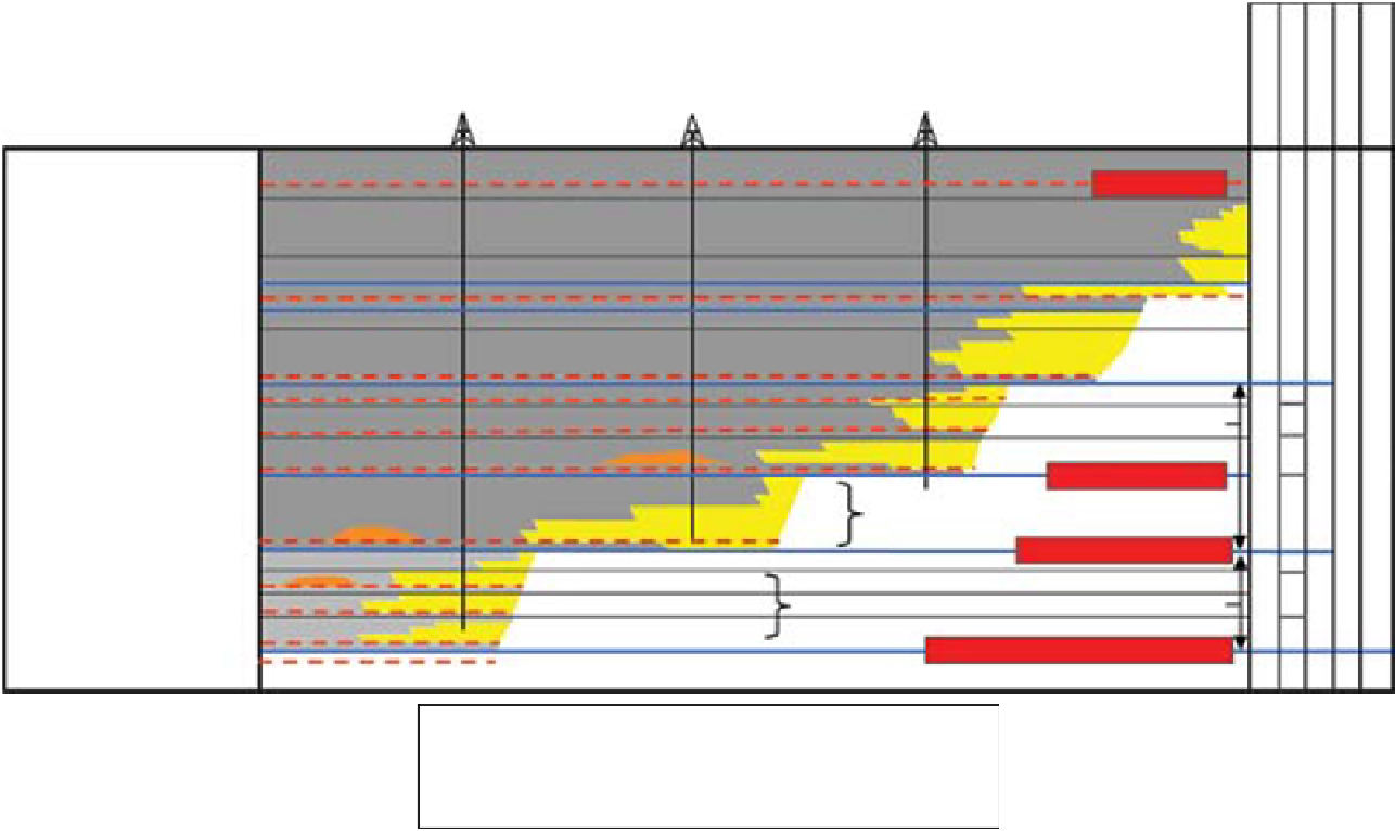
Fig. 3.
Central North Sea biostratigraphic scheme showing schematic long term retrogradational stratigraphy of sequence sets J50 to J70. This figure has been
adapted after Partington
et al
. (1993b), retaining only data from the Central Graben. Sequence boundary locations proposed by Partington
et al
. are indicated
with names based on the colour scheme of Donovan
et al
. (1993) and the SJU sequence boundary naming scheme of Veldkamp
et al
. (1996). Relationship of
named sequence boundaries to named MFS follows that given by Veldkamp
et al
. (1996). Brown, Yellow and Green sequence boundaries were not shown
on the original figure of Partington
et al
. from which this figure is adapted. Dating of the Fulmar Sst of the Fulmar Field is from Kuhn
et al
. (2003). Dating
of the Gyda Sandstone of the Fulmar Field is from Partington
et al
. (1993a) and dating of the Franklin Sst is from Lasocki
et al
. (1999) and subsequent stud-
ies. Seismic horizons interpreted by this study are also indicated. The turbidite sandstone marked 'Shearwater' is the turbidite sandstone lying immediately
above shoreface sandstones in the 22/30b-11 well (as described by Jeremiah and Nicholson, 1999).


Search WWH ::

Custom Search