Geoscience Reference
In-Depth Information
structural development of the area but argue that
the movement of the salt was, in many cases, trig-
gered by reactivation of deeper fault zones and, as
such, was passively deformed during the struc-
tural development. Other authors (e.g. Erratt,
1993; Helgeson, 1999) were more interested in
demonstrating the importance of Zechstein salt in
the mechanical decoupling between basement
Rotliegend fault blocks and the overlying Triassic.
They showed examples of the relationship
between faulting and halokinesis that focused on
the interaction of basement tectonics and pod/
interpod complexes. In the view of these authors,
a pure extensional setting existed in the Central
Graben with structures in the Triassic-Jurassic
carapace influenced by extension and halokine-
sis. An alternative interpretation is that an
oblique-slip regime had existed in the Central
Graben (Bartholomew
et al
., 1993; Sears
et al
.,
1993) with the local development of transpres-
sional and transtensional domains.
The presence of two clear extensional fault
trends in the Central Graben aligned NNW-SSE
and NW-SE (Fig. 1) is interpreted by Erratt (1999)
and Davies
et al
. (1999) to reflect a polyphase
Jurassic extension history in which the kinematic
axes were aligned with an initial W-E extension
during the Bajocian and Bathonian and a later
NW-SE extension during the Kimmeridgian to
Volgian. The oblique-slip model places more
emphasis on the role of basement structures and
their continued influence on the structural style
of the Jurassic to explain the same trends
(Bartholomew, 1993).
Where the Zechstein salt is thick, salt tectonics
and Triassic minibasin development can very
Forties-
Montrose
High
Norway
200km
Ula
Shearwater
Studied
Region
Elgin
Figure 15
NORTH SEA
Franklin
UK
Gyda
Figure 12
Puffin
2/4-14
Figure 11
UK Sector
Jacqui
Figure 22
1/6-6 & 7
Norwegian Sector
Fulmar
Figure 10
West
Central
Shelf
Top Pre-Zechstein
(Depth, metres)
< 4500
N
4500-7500
50 km
Danish Sector
7500-10000
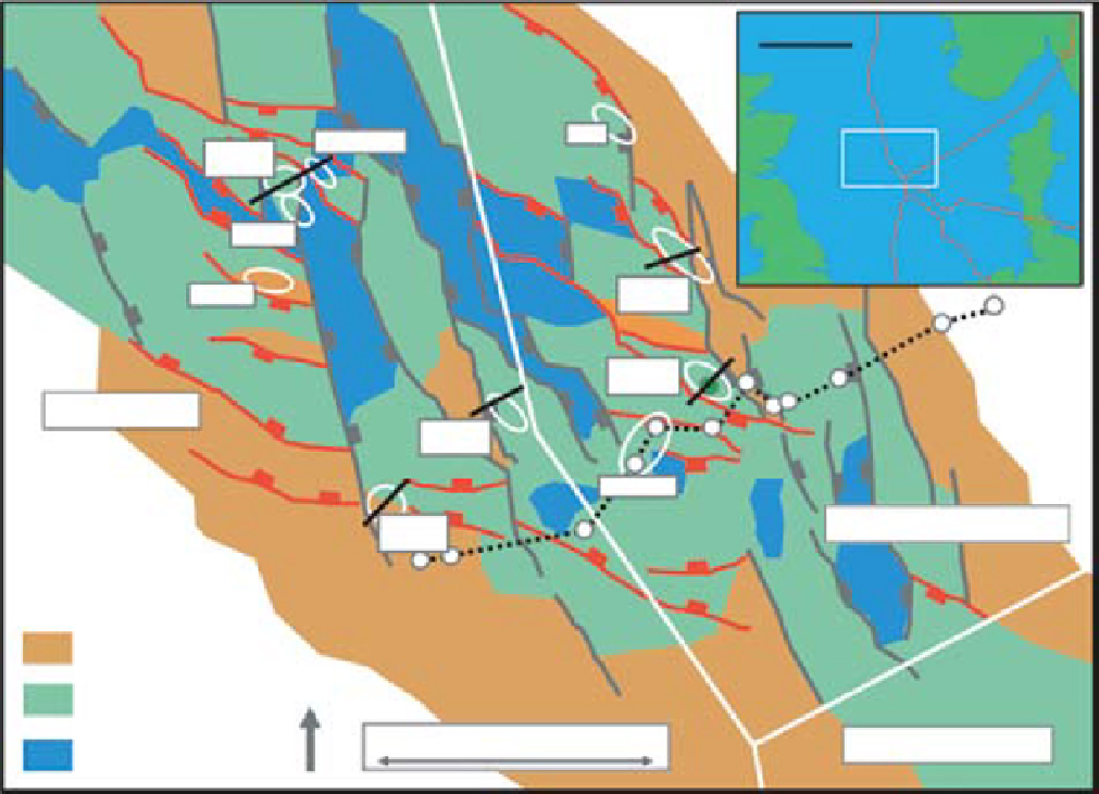
Fig. 1.
Top Pre-Zechstein simplified depth map showing location of major faults that have been reactivated by Upper
Jurassic rifting. Early developed NNW-SSE aligned extensional faults are shown in black whilst later developed NW-SE
aligned extensional faults are shown in red. The location of a geological structural section shown in Fig. 2 is indicated by
the black dotted line between white well locations. The locations of several geological sections discussed in this paper are
also indicated on the map with their associated figure numbers.
Search WWH ::

Custom Search