Geoscience Reference
In-Depth Information
3) T = 154 ka - Maximum sea-level fall of the fast cycle
6) T = 320 ka - The end of the simulation
Mature network
320 ka
Filling of the upper catchment area
High plateaus
300
Widespread fluvial plain
Deep incised valley
Large delta
256 ka
Shelf-edge delta
200
162 ka
132 ka
154 ka
100
78 ka
5) T = 256 ka - Maximum sea-level rise of
a superimposed cycle
2) T = 132 ka - Maximum sea-level rise at the end of the slow cycle
Mature network
0
-200
Sea-level (m)
-100
More mature network
High plateaus
High plateaus
Filling of the incised valley
Large delta
Widespread fluvial plain
Fluvial
Channel
(w.d. < 0, s.t. > 0)
1 < Q < 10 m
3
/s
10 < Q < 100
Q > 100 m
3
/s
-5 m
0 (Shoreline)
50 m
4) T = 162 ka - Maximum sea-level rise at
the end of the fast cycle
100 m
1) T = 78 ka - Maximum sea-level fall of the slow cycle
200 m
500 m
Youthful network
Mature network
High plateaus
High plateaus
Basement
(s.t. = 0)
Widespread fluvial plain
Small incised valley
w.d.: water depth [m], s.t.: sediment thickness [m]
Q: water discharge [m
3
/s]
Large delta
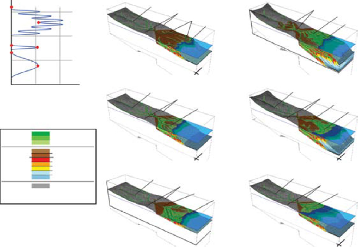
Fig. 6.
Analysis of the evolution of sedimentary environments in response to sea-level cycles in the case of the source-to-sink model.
Search WWH ::

Custom Search