Geoscience Reference
In-Depth Information
64
°
N
60
°
Norway
56
°
Denmark
UK
100 km
0
°
Germany
60
°
4
°
8
°
12
°
Norway
Denmark
56
°
0
°
4
°
8
°
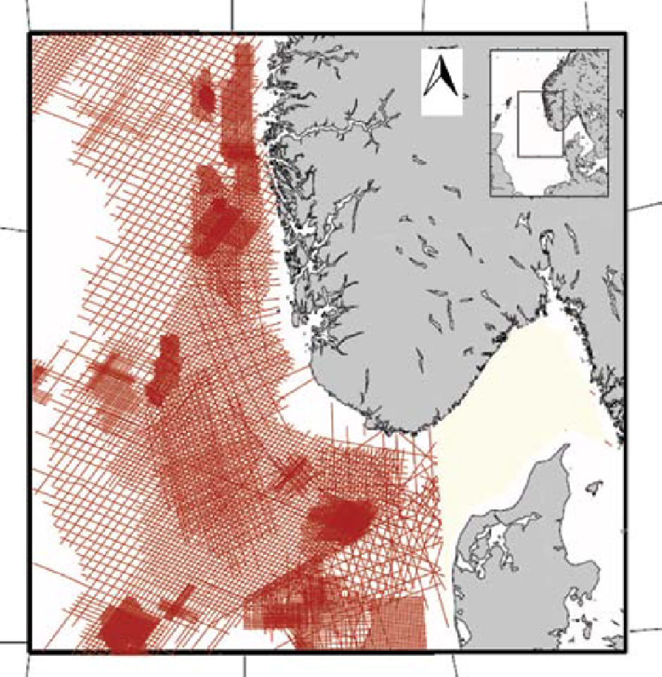
Fig. 1.
Location of the study area and the reflection seismic data applied in the present study.
2003 and 2009. Furthermore, several additional
2D seismic surveys were utilised, including the
surveys DCS, DK1, DK2, DT97, SP82 and UCGE97,
mainly in the Danish sector (Fig. 1). The NSR
survey is a regional, state-of-the-art reflection
seismic survey, which offers excellent seismic
resolution of the Mesozoic, as well as the Cenozoic
successions. This survey covers the Norwegian
part of the study area. Combined with the other
2D seismic surveys used in this study, the data
coverage exceeds that of previous investigations,
particularly so for the southern parts of the
Norwegian Sector of the North Sea Basin. Thus,
the present database allows a more complete
interpretation of the Late Mesozoic (Late Jurassic
to Cretaceous) and Cenozoic successions.
The seismic data have been tied to a large num-
ber of wells which provide biostratigraphic and
lithostratigraphic information and are used to
calibrate the seismic stratigraphic framework.
The seismic mapping and interpretations are
based on seismic stratigraphic principles, such as
Search WWH ::

Custom Search