Geoscience Reference
In-Depth Information
100 km
10º W
0º
0º E
20º E
(A)
(B)
Norway
Stord
Basin
N
Egersund
Basin
Jaeren High
60º N
Moray
Firth
northern
North Sea
Norwegian
Danish
Basin
Western
Platform
central
North Sea
central North
Sea
Ringkøbing-
Fyn High
Mid-North Sea High
Solway
Basin
southern North
Sea
Ireland
Southern Permian Basin
UK
East
Irish
Sea
UK
50º N
N
Greenland
Fluvial sandstones
Playa mudstones
Anhydritic mudstones
Halite
Marine limestones
(C)
(D)
Norway
Norway
15
19
18
16
17
14
15
16
12
5707
11
10
9
Central
North
Sea
7
8
19
20
21
22
23
UK
4
3
2
1
5607
5606
5605
26
29
27
28
30
5604
5503
5505
5506
5507
5504
Southern Permian Basin
A
38
34
35
36
37
B
A
D
C
E
B
Rhenish
Massif
Bohemian
Massif
G
H
J
41
42
43
44
F
E
Armorican
Massif
D
G
H
M
L
J
M
N
49
47
48
L
K
UK
Tethys
Q
52
53 0 P
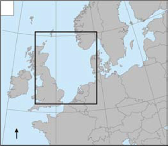
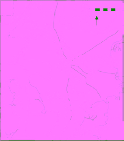
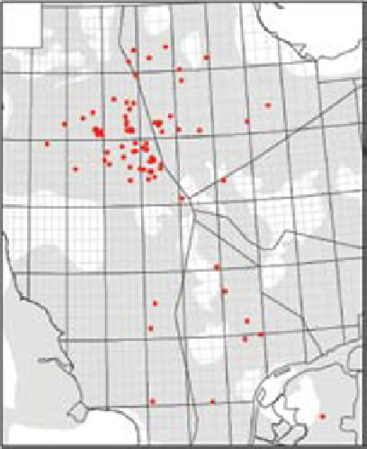
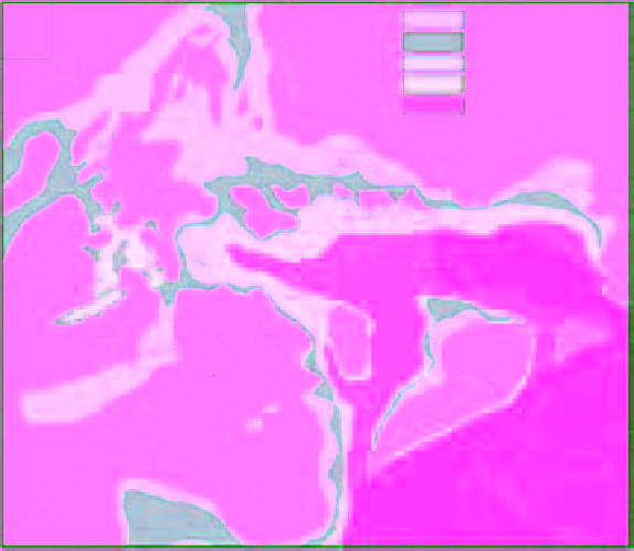
Fig. 1.
Central North Sea location and distribution of Triassic basins. (A) General North Sea location map.
(B) Distribution of Triassic basin-fills across the North Sea region (based on Goldsmith
et al
., 2003 and Geluk, 2005).
Erosional gaps within the Triassic basin distribution mark the positions of footwall unconformities which trace
the overprint of the cross-cutting Jurassic rift system. (C) Location of wells referred to in the text. (D) Gross
palaeogeographic setting of the central North Sea (after McKie & Shannon, 2011) in relation to the Southern Permian
Basin and the margin of the Tethys Sea. The map broadly corresponds to the Late Anisian when Tethyan flooding of
the Southern Permian Basin created the Muschelkalk seaway adjacent to the central North Sea. Marine access to the
Southern Permian Basin was via restricted straits which dissected the chain of massifs marking the remnants of the
Variscan mountains.

Search WWH ::

Custom Search