Geoscience Reference
In-Depth Information
(A)
AU
Locality N1
Locality N2
Locality N3
Locality N4
(B)
Localities N1-3, measured sections 18-29
AE
Section 18
Section 19
Section 23
Sections 27 & 28
Section 29
MFS5
FSg
SU3/TS6
260
40
SU3/TS6
30
230
250
20
220
240
M
FS5
FS-f
210
10
230
SU2/TS5
SU1/TS3
0m
200
220
sub-aerial
sub-aquaous
240
MFS5
Silt
Sand
Clay
Gr.
Pbl.
40
NNW
~16-km
SSE
heterolithic
70
190
210
230
sandy
30
60
200
180
220
20
50
170
190
210
Fig.C
10
FSf
40
160
180
200
0m
30
150
170
Silt
Sand
190
Clay
Gr.
Pbl.
20
140
160
180
10
130
150
170
Fig.D
SU2/TS5
0m
140
120
160
Silt
Sand
Clay
Gr.
Pbl.
MFS3
110
130
150
100
120
Qz
140
Qz
90
110
SU1/TS3
130
80
100
120
Silt
Sand
Clay
Silt
Sand
Clay
Gr.
Pbl.
Gr.
Pbl.
110
Silt
Sand
sandstone
siltstone
mudstone
Clay
Gr.
Pbl.
(E)
Locality N2
Section 23
Fig. 13.
(A) Detailed sedimentary logs (depths in m) showing sedimentology, architectural element and key surfaces in the
northern area (localities N1 to 4). (B) A schematic presentation of a possible depositional scenario for the AU8. Note the rela-
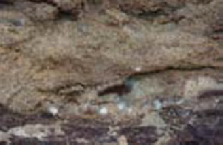
tively similar palaeocurrent directions. (C) Photo of upward facies transition across the flooding surface FSf that separates the
sandy heterolithic TDEC and muddy heterolithic WDDL elements at locality N4 (measured section 29). (D) Photo of matrix-
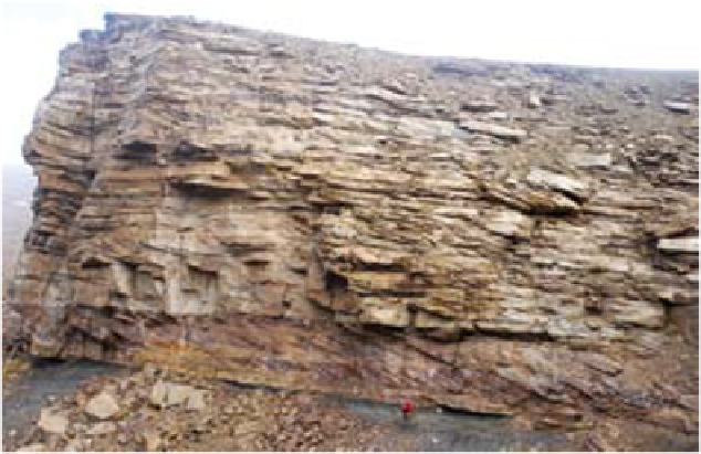
supported conglomerate bed directly overlying the combined SU2/TS5 unconformity surface at locality N3 (measured sec-


Search WWH ::

Custom Search