Geoscience Reference
In-Depth Information
72°
25°
24°
23°
22°
71
′
5°
Gule Horn
N4
N3
Liaselv
Lepidop-
N2
teriselv
N1
Pase-Elv
Jameson
Land
71°
Hall B
redning
S8
S7
Dusen Bjerg
Elis Bjerg
Liverpool
Land
Nathorst Fjeld
S6
Te rtiary volcanics
Constable Point
Airfield
Harris Fjeld
S5
Cretaceous
Hare-Elv
Jurassic
Moskusoksekløft
S4
Astartekløft
Neill Klinter Group
S3
Skævdal/Albuen
Tr iassic
70
′
5°
S2
Permian
S1
Carboniferous
Devonian
Crystalline basement
24°
23°
22°
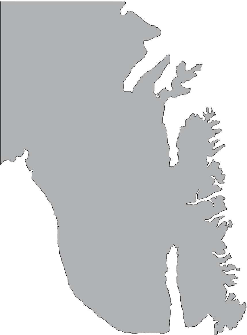
Fig. 4.
Geological map of the Jameson Land region showing the outcrop of the Neill Klinter Group (in orange). The inves-
tigated localities in this study are S3 to 6 in the southern area and N1 to 4 in the northern area. Sections in localities S1 to
2 and S7 to 8 area are redrawn from Dam & Surlyk, 1998.


Search WWH ::

Custom Search