Geoscience Reference
In-Depth Information
Base Shetland
-
+
1800
Top Garn
Top Ile 1
1850
Top Tilje 3.4
Top Åre 6.2
1900
1950
Top Åre 1
2100
2150
2200
2250
2300
2350
2400
7°15
ʹ
7°20
ʹ
2450
65°21
ʹ
2500
2550
65°20
ʹ
2600
2650
65°19
ʹ
2700
012
km
2750
65°18
ʹ
500 m
7°15
ʹ
7°20
ʹ
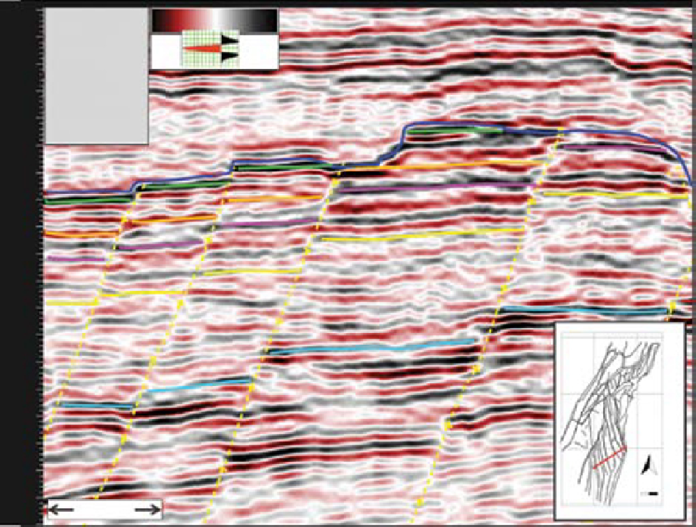
Fig. 25.
Seismic section from the southern part of the Heidrun Field. Yellow dashed lines indicate segment bounding
faults. Field wide seismic horizons are interpreted at the top of the Åre 1 Zone (Top Åre 1) and at the top of the Åre 6 Zone
(Top Are 6.2). Vertical scale is given in ms TWT (milliseconds Two Way Travel-time).
Deposition of the Åre Formation within the
Halten Terrace region took place during a rift ini-
tiation phase characterised by local faulting and
associated variable subsidence (Marsh
et al
.,
2010). These faults are likely to have had a signi-
ficant control on accommodation space and
sediment supply within the basin, as indicated by
a seismic study from the Åsgard Field which
shows internal thickness variation within the Åre
Formation (Marsh
et al
., 2010). Here, the syn-
sedimentary tectonic control is indicated by, for
example, wedge-shaped and thicker stratigraphic
intervals in the hangingwalls of active faults rela-
tive to the footwall (Marsh
et al
., 2010). Seismic
data from the Heidrun Field, on the other hand,
do not show any convincing evidence of thickness
variation within the Åre Formation across faults
(Fig. 25). This is also confirmed by isochoring
of reservoir zones based on well analysis.
Thickness maps from main reservoir zones
defined by flooding surfaces indicate fairly uni-
form trends within the Åre Formation across the
field. However, significant thickness variations
are observed within the reservoir sub-zones which
are associated with sequence boundaries (c.SB1,
c.SB2 and c.SB3; Table 1). The seismic reflectors
within the Åre Formation on Heidrun are approxi-
mately 200 m apart (i.e. MFS1 and TRS) and the
seismic data quality are insufficient to resolve
internal thickness variations on a reservoir sub-
zones scale (for example the 10 m relief at the
c.SB2 at the Åre 5.2 Sub-zone; Fig. 18). Lowstand
fluvial incision and subsequent estuary develop-
ment during marine transgression is, in most
cases, related to eustasy and/or tectonic uplift
(Dalrymple
et al
., 1994). Tectonically induced
Search WWH ::

Custom Search