Geoscience Reference
In-Depth Information
(A)
(B)
(C)
(D)
Fig. 17.
Conceptual model to explain the evolution of delta lobe bay-fill cycles.
A) Development of brackish water embayment. B) Fluvial channel seeking base-
level triggers renewed progradation at embayment margin. C) Progradation of
wave-dominated delta lobe across the floor of the embayment. D) Area of embay-
ment completely filled. Potential for channel abandonment, compactional
subsidence, flooding and renewed progradation.
7°15
ʹ
7°20
ʹ
NW
6507/7-A-46
z
SE
65°21
ʹ
RHOB
NPHI
6507/8-F-1H
z
GR
6507/7-A-40
z
RHOB
NPHI
GR
GR
RHOB
NPHI
MFS3
6507/7-A55-T2
z
RHOB
NPHI
GR
65°20
ʹ
TRS
c.SB3
65°19
ʹ
FS3
012
km
65°18
ʹ
7°15
ʹ
7°20
ʹ
LEGEND
Sandy bayfill
Heterolithic bayfill
Distributary channel
Floodplain/baymargin mud
Bayfloor mud
Tidally-influenced distributary
channel
Heterolithic tidal flat
Tr ansgressive shoreface
Peat swamp coal
Flooding surface (FS)
Maximum flooding surface (MFS)
Candidate sequence
boundary (c.SB)
Tr ansgressive ravinement
surface (TRS)
c.SB2
FS2
MFS2
20
10
Metres
0
500
1000
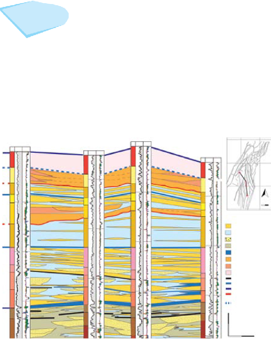
Fig. 18.
NW-SE oriented cross-section showing vertical and lateral distribution of facies associations within the Åre 3 to
6 Zones and the interpreted stratigraphic surfaces. Note the down-cutting of the tide-influenced distributary channel
deposits at the base of Åre 5.2 to the NW. See Fig. 4 for abbreviations.


Search WWH ::

Custom Search