Geoscience Reference
In-Depth Information
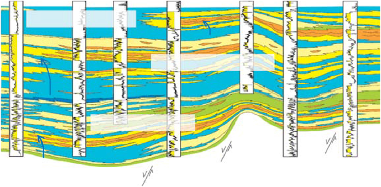
(A)
95 km
6406/8-1
6406/9-1
Linnorm
6406/6-2
6407/4-1
6407/6-5
Mikkel
6407/6-1
6408/4-1
W
E
20 km
9 km
15.5 km
26 km
13 km
18.5 km
Garn
Fm
Garn megasequence
Ile
Fm
Tofte-Ile megasequence
Ror-
Tofte
Fms
Tilje
Fm
Tilje megasequence
200 m
Åre
Fm
6°E
7°E
8°E
N
97
6506
9
7
9
7
6507
6508
Legend
12
11
12
11
0 m
65°N
Delta-plain, back-barrier and
upper tidal flat heterolitics
3
3
Timeline
Fluvial channel-fills and
channel-belt sandstones
Fluvial- and wave-dominated deltaics,
and wave-dominated shorelines sandstones
Tidal-dominated deltaics, estuarine,
tidal-flats and tidal dominated shorelines heterolitics
19
Aggradation to
retrogradation
64
5
6
4
5
6
4
6406
6407
6408
Progradation
9
7
9
7
Offshore to shelfal mud- and claystones
Normal fault
12
10
11
12
10
11
10
12
11
Shelfal organic-rich claystones
Megasequence boundary
64°N
0
10
km
20
2
3
2
3
3
1
1
6306
6307
Fig. 4.
(A) West-East oriented well correlation of the Lower and Middle Jurassic megasequences on the Halten Terrace area, mid Norway.


Search WWH ::

Custom Search