Geoscience Reference
In-Depth Information
1°40
ʹ
2°20
ʹ
2°40
ʹ
2°
61°30ʹ
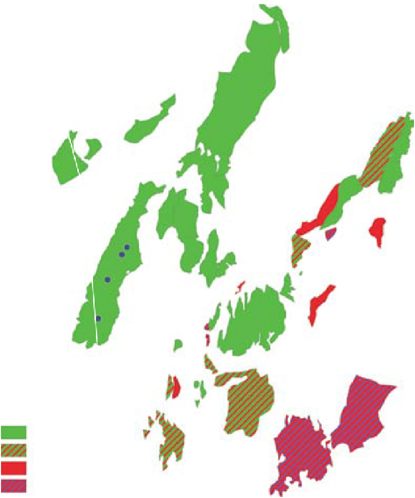
Snorre
Sygna
Statfjord Nord
Visund
Murchison
Statfjord
Øst
Vigdis
1 & 2
Visund Sør
3
To rdis
4
61°15
ʹ
GIMLE
Statfjord
5, 6 & 7
Gullfaks
Gullfaks Sør
Kvitebjørn
Oil
Oil/gas
Valemon
Gas
61°
0
10 km
Gas/condensate
Fig. 2.
Map of the hydrocarbon fields on the Tampen area with the outline of the Statfjord licence and surroundings; the
study area is part of the Statfjord Field. The sea bottom locations of the cored wells used to construct the correlation
of Fig. 12 are indicated (numbers refer to well numbers). Approximate well distances are given at reservoir depth
(top Statfjord Group). Modified after Norwegian Petroleum Directorate fact maps.
well data analysis. Consequently, an alternative
way of dividing continental fluvial stratigraphy is
proposed that is in contrast to a more static subdi-
vision in low and high accommodation zones.
Accommodation is defined following Muto & Steel
(2000) as 'the thickness, measured at a specific site
and time, of a space which becomes filled with
sediments during a specified time interval'.
It is suggested that the theoretical foundation
that justifies this approach lies in the allogenic
forcing mechanisms on a fluvial system. For exam-
ple, climate control on long-term water discharge


Search WWH ::

Custom Search