Geoscience Reference
In-Depth Information
villages. The Udaipur district is bounded by Rajsamand district in the north,
Pali district in the northwest, Dungarpur and partly Banswara districts in the
south and Chittaurgarh district in the east.
The climate of Udaipur is tropical, semi-arid with mercury staying between
a maximum of 42.3 °C and a minimum of 28.8 °C during summers.
Winters
are a little cold with the maximum temperature rising to 28.8 °C and the
minimum dipping to 2.5 °C. January is the coldest month and May is the
hottest month. The mean annual rainfall is 625 mm, precipitating more than
80% during June through September. The rainy season (i.e., wet season)
usually starts from mid-June and lasts for about four months up to the end of
October. November to May can be characterized as the dry period.
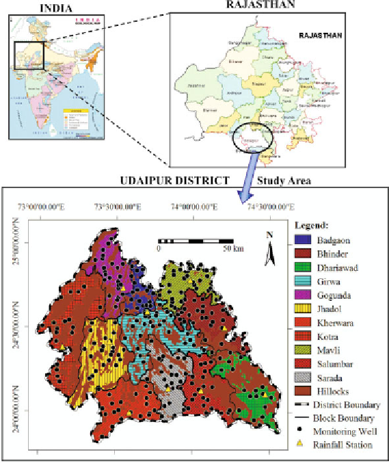
There are ten rainfall gauging stations in Udaipur district for recording
rainfall on a regular basis. The locations of the rainfall stations are shown in
Fig. 8.1. Monthly rainfall data of these ten standard rainfall stations for the
Fig. 8.1.
Location map of the study area.
Search WWH ::

Custom Search