Geoscience Reference
In-Depth Information
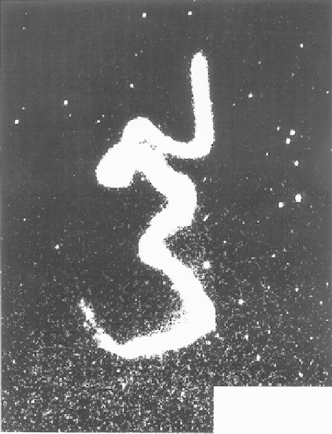
TMA Trail
June 11, 1978
0634 UT
(Wallops Island, VA)
Figure 6.1
A TMA trail deployed from Wallops Island, Virginia on June 11, 1978, at
0634 UT. The trail was photographed from the NASA C54 airplane. (Courtesy of I. S.
Mikkelsen.)
on the distortion of the trail by the ambient winds, but numerous reversals and
shears are evident. From (6.5) the theoretical prediction is that the wave ampli-
tude should grow as it propagates upward (positive
z
). The physical explana-
tion for this somewhat bizarre result is that to conserve the wave perturbation
energy (e.g., terms of the form
v
2
must increase.
The factor of 2 in the exponential form occurs, since, in order to keep
ρ
0
v
2
)as
ρ
0
decreases with
z
,
ρ
0
v
2
constant,
v
need only
e
-fold over a height interval 2
H
when
ρ
0
decreases by a
factor of
e
in the height interval
H
. The classical observation supporting this
result is shown in Fig. 6.2a. The dashed curve shows the mean wind. The actual
wind fluctuates about this mean with an amplitude that increases with height.
In Fig. 6.2b a detrended version of the same data is given after subtracting the
mean and multiplying by exp
where
z
and
H
are measured in kilo-
meters. This procedure “undoes” the effect of the exponential atmosphere, and
the wave component appears constant with altitude. A schematic representation
[
(
112
−
z
)/
2
H
]
Search WWH ::

Custom Search