Geoscience Reference
In-Depth Information
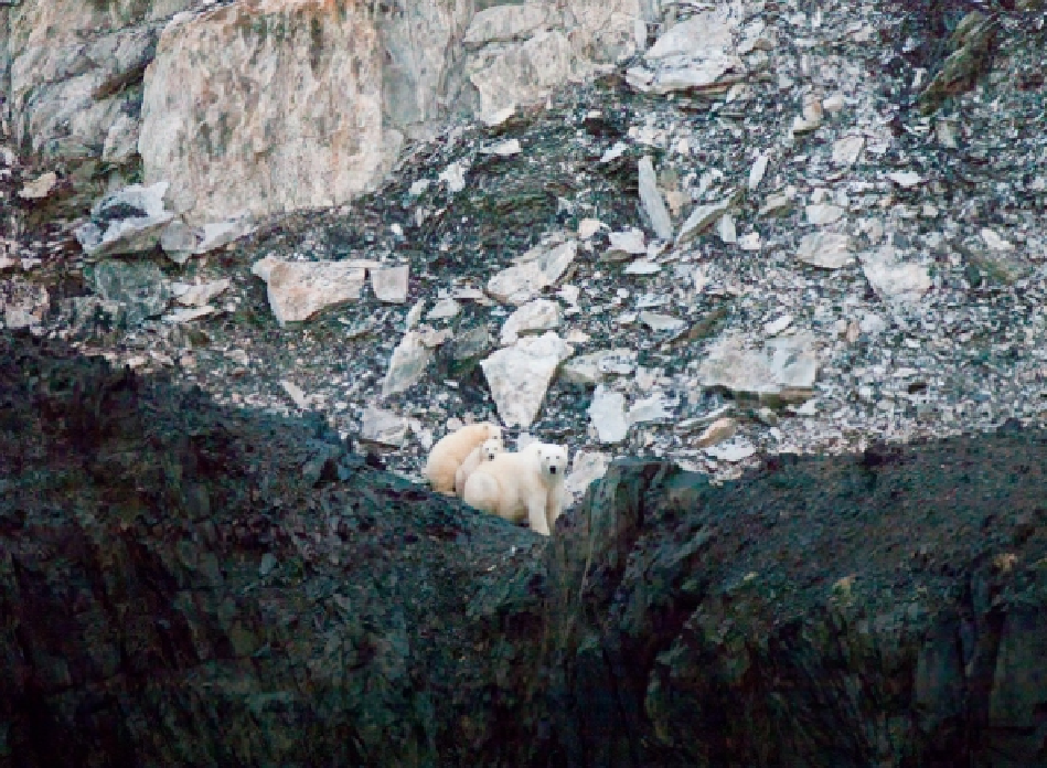
A polar bear shelters her twin cubs in a dark cleft of the Torngat Mountains, rising from the Labrador Sea.
The Gulf Stream, a warm, salty 100-kilometer- (60-mile-) wide river in the sea, acts as a foil to the Labrador
Current's chilling effect. Born in the Gulf of Mexico of the Guiana Current and the North Equatorial Current,
the Gulf Stream flows like a warm water jet out through the Florida Straits and follows the coastline until it be-
gins to veer away north of Cape Hatteras, swirling and becoming more turbulent as it heads into the open
ocean. Its influence continues to be felt in the Mid-Atlantic region and farther north, however, as pinched-off
eddies called warm-core rings drift slowly westward, bringing Gulf Stream waters close to the edge of the con-
tinental shelf in the Gulf of Maine and along the Scotian Shelf.
Ecologically, the divide along this grand sweep of coast, from roughly the 60th to the 35th parallel, is Cape
Cod. The cape projects into the North Atlantic like a police officer's arm directing marine traffic. South of it,
waters are too warm to permanently accommodate animals native to the boreal Acadian zone in the north.
North of the cape, cooler waters act as a barrier to animals endemic to the Mid-Atlantic region, or Virginian
zone, in the south. This separation of northern and southern species is a consequence of water temperature,
which on average is several degrees colder—thanks to the Labrador Current— on the northern shore of the
cape than on the southern shore. The landforms north and south of the cape also differ, largely as a result of the
difference in the glacial history of the region. In the north, where the Wisconsinan glacier scraped its way
across the landscape like a giant bulldozer blade, the contemporary coastline still bears its scars; it is deeply in-
dented, consisting of rocky beaches and cliffs where softer sediments have been largely removed. South of the