Geoscience Reference
In-Depth Information
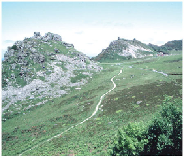
FIG
88.
The Valley of the Rocks, west of Lynton. (Copyright Landform Slides - Ken Gard-
ner)
The raised beaches at Baggy Point (
a10
) and 3 km to the south at Saunton Down
provide further evidence of a higher sea level in the past. They are clearly defined and
run for about 4 km at a level about 15 m above today's sea. Several deposits of sands
and gravels are preserved, cross-cutting the layering of the bedrock beneath. These
beaches must have formed before the ice sheet of the last (Devensian) cold phase of the
Ice Age reached its maximum extent (Fig. 49). Associated with these beaches is a re-
markable range of boulders and pebbles from igneous and metamorphic sources much
further north. The growth and decay of ice sheets along with variations in sea level
provide an extraordinary range of possible episodes in which these boulders might
have been transported.
Landscape B: The Culm (Carboniferous) bedrock area
Culm bedrock underlies the southern part of Area 3 and also the northern part of
Area 2. Together these two parts form the Culm fold belt (Fig. 39), which is the Var-
iscan downfold between the older rocks of Exmoor and the Dartmoor-Bodmin Moor
uplands. The Culm rocks have not resisted landscape erosion as much as the older
rocks to north and south, and so have formed a lower landscape, not exceeding 250 m
above sea level. The area is rural and sparsely settled, with an economy relying pre-
dominantly upon dairy farming.