Geoscience Reference
In-Depth Information
tivated. Historically the islanders eked out a precarious existence from crofting, until
the nineteenth century, when shipbuilding and the growing of flowers became econom-
ic. Today most of the cultivated land consists of small fields of flowers edged with
evergreen hedges, and horticultural work, along with tourism, has become the main-
stay of the economy.
The smaller islands are often arranged in rows, separated by 'sounds' (areas of
shallow water) that tend to have a northwest-southeast orientation. These sounds must
have been valleys before they were drowned by the recent (Flandrian) sea-level rise.
Their orientation is similar to that of the valleys and faults of the Land's End gran-
ite, discussed more fully below. Numerous sandy bays and beaches reflect the granite
weathering and the transport of the weathered sediment, by storms and tides, to more
sheltered parts of the island landscape.
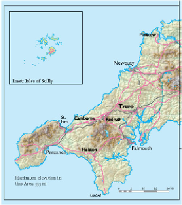
FIG
51.
Natural and man-made features of Area 1.
In the general section of this chapter it has been mentioned that the northern Scil-
lies appear to have been invaded by ice late in the history of the last (Devensian) cold
phase of the Ice Age (Fig. 49), and this is surprising in view of their southerly loca-
tion. It appears that when the Devensian ice sheet had grown to its greatest extent, an
elongate tongue of ice, perhaps some 150 km wide, extended for nearly 500 km from
the Irish and Welsh ice sheets to the edge of the Atlantic continental shelf. This tongue
became so large because it was vigorously fed by ice from the high ground of Ireland