Geoscience Reference
In-Depth Information
iscan structures, deeper in the crust, that became active again when later crustal forces
were sufficient.
In terms of the making of Southern England, it can be claimed that the convergent
movements of the Variscan mountain building have given local and regional features
of the Southwest and South Coast their orientation.
EPISODE 2: THE SOUTHEAST ENGLAND BASIN
The Variscan mountain-building episode was followed by an episode, almost 300 mil-
lion years long, in which the crust of southeast England subsided, and sediments accu-
mulated in the resulting basin. For this overview, I pick out three levels in the Permian,
Mesozoic and Tertiary sedimentary succession. Each of these levels (Fig. 317) contains
particularly resistant bedrock, so has tended to produce hills of regional landscape im-
portance. Each level has also acted as an indicator of the net extent of earth movement
since it formed as a relatively flat layer.
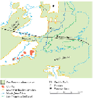
FIG
317.
Southern England and surroundings, showing the cover of sediment (Permian,
Mesozoic and Tertiary in age) formed during Episode 2. On land, the outcrop locations of
the three levels in this bedrock cover are mapped: (A) lower New Red Sandstone; (B)
Middle Jurassic; (C) Late Cretaceous Chalk.
Although this selection of the three levels picks out erosion-resistant, hill-forming
sediments in the succession, it is important to realise that the Southeast England basin-
fill consists predominantly of mudstones that are easily eroded. This is one reason why
the present-day landscapes are generally so low and gentle.
A: Lower New Red Sandstone level
We have already explored numerous local situations, particularly in Areas 2, 3, 8 and 9,
where the contact between the Variscan-deformed Devonian and Carboniferous rocks
and the overlying New Red Sandstone is very distinctive. This contact provides vivid