Geoscience Reference
In-Depth Information
and into the Oxford Clay beneath. These valleys must have formed since the end of the
Anglian glaciation about 400,000 years ago.
In pre-Anglian times, perhaps 600,000 years ago, a large eastward-draining
'Bytham River' is thought by some to have flowed across this Area (Fig. 267). The
evidence comes from sediment grains found in the far east of Area 15, which appear to
have originally come from bedrocks in the West Midlands and Wales. This river must
have flowed at a higher level than most of the present surface, because its course bears
little relationship to present valleys or to the flow directions of present rivers.
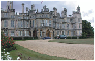
FIG
271.
Burghley House, near Stamford.
The slope map of sub-area I, around the Vale of Belvoir (Fig. 269), helps us re-
cognise some further episodes in the formation of the landscape. The key to this is the
realisation that some parts of the local area are characterised by slopes that are capped
by - and largely cut into - the bedrock, whereas in other parts the capping material
is largely sediment left by the Anglian ice sheets. These deposits cover large parts of
the landscape, capping some of the highest elevations and carpeting some of the low
areas in the southwest. The western edge of the Vale of Belvoir (
b1
) consists of Angli-
an material, still not removed by later erosion. The southern section of the southeastern
edge is largely capped by Early Jurassic lithologies, except for two places (
b2
and
b3
)
where pre-Anglian valleys, plugged by ice-laid deposits, have been cut across by later
erosion. To the north of this, Early and Middle Jurassic layers form the double edge of
the Vale, and have been stripped of Anglian material. To the east of the Vale of Belvoir
is the Ancaster Gap (
b4
), now used for road and rail transport (via Sleaford) through
the Middle Jurassic scarps. It appears to be large enough to have been carved by early
ancestors of the River Trent, which may have been the agents for the general removal
of the Anglian cover from the floor of the Vale and its southeastern edge.
In the southeast of Figure 269, the pattern of shallow valleys of the Witham (
b5
)
and the West and East Glen (
b6
and
b7
) is remarkably rectangular, suggesting some
fracture pattern in the bedrock, perhaps due to stresses linked to earth movements.
Similar ideas, based on the distribution of Anglian material, can be applied to sub-
area II, around Oakham (Fig. 272). Here the cover of Anglian material is general ex-
cept for a large part of the northeast, where the larger rivers (for example the ancestral