Geoscience Reference
In-Depth Information
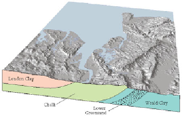
FIG
214.
Oblique hill-shaded map of Area 12 showing bedrock geology.
The Weald Uplift continues south and west of this Area, and is examined in more
detail in Areas 6, 7 and 11. The origin of the Wealden bedrock as a southerly-building
Early Cretaceous delta is discussed in Chapter 5, Area 6.
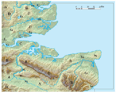
Landscape B: The North Downs and Isle of Thanet
The North Downs are the most clearly defined and easily followed topographic feature
of this Area. The Downs rise to heights of over 190 m above sea level and have the
typical shape of a hill range formed by erosion of a tilted layer of resistant bedrock: the
north slope of the Downs is relatively gentle, following the northerly dip of the Chalk
layers, while the southerly slope is a steep scarp, because here the Chalk has tended to
collapse along internal fracture surfaces, which are often steeply inclined.
FIG
215.
Map of Area 12, showing Landscapes
A
to
D
and localities (
a1, a2
etc.) men-
tioned in the text.