Geoscience Reference
In-Depth Information
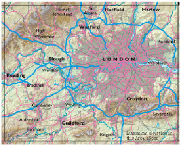
FIG
197.
Location map for Area 11.
As Figures 200 and 201 show, London has grown in the natural basin created by
the Chiltern Hills to the northwest and the North Downs to the south. The centre of this
basin, including most of Greater London, is dominated by the River Thames and its
floodplain, along with a number of isolated hills. In spite of the remarkable growth of
Greater London, the river still dominates the scenery at its heart, and has created most
of the local slopes and hilly viewpoints. Towards the west end of the basin, around
Bracknell, are the Thames Basin Heaths, while to the east the River Thames broadens
out into a wide estuary (Area 12). The Thames and its estuary have been key factors in
London's remarkable growth and development.
I have divided this Region into seven Landscapes, indicated by the letters
A
to
G
on Figure 201.
Landscape A: The Vale of Aylesbury
This Landscape is defined largely by its low elevation relative to the Chiltern Hills to
the southeast. The bedrock consists of largely Late Jurassic mudstone (mainly Kim-
meridge Clay and Portland Beds) covered by mudstones of the Early Cretaceous Gault
Clay, so it is not surprising that the land is relatively low-lying and lacks obvious to-
pographic features. This Landscape links with more mudstone lowlands to the west
(Landscape
B
of Area 10) and with the Clay-Greensand-Gault belt to the northeast
(Landscape
B
of Area 13).
FIG
198.
Natural and man-made features of Area 11.