Geoscience Reference
In-Depth Information
S
N
a)
400
300
350
450
500
SP
0.0
0
0.1
500
0.2
0.3
1000
0.4
1500
0.5
0.6
2000
Two-way
time (s)
Approximate
depth (m)
0
1000
Metres
b)
300
350
400
450
500
SP
0.0
0
0.1
DR
Wabassee \group
KT
500
0.2
0.3
Watson
Lake Group
1000
Gabbro sills
BA
0.4
1500
0.5
Bell River
Complex
0.6
2000
Two-way
time (s)
Approximate
depth (m)
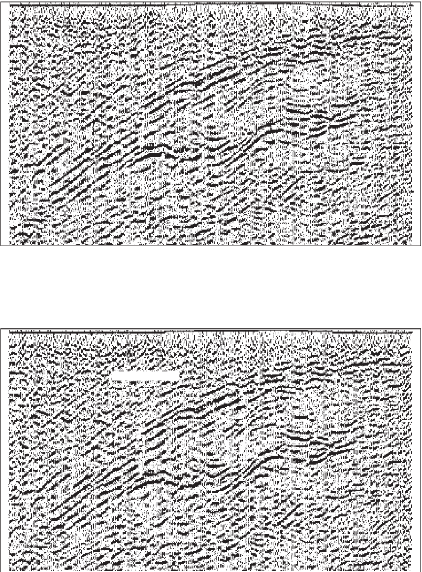
Figure 6.48
Migrated zero-offset seismic re
ection section across part of the southwestern limb of the Galinée Anticline. (a) Uninterpreted data,
and (b) major stratigraphic markers and faults (red) interpreted from the data. BA
-
Bell Allard VMS deposit, DR
-
Dumagami Rhyolite,
6.8.1
In-seam surveys
domain of the coal industry. Drillhole-to-drillhole (down-
hole) tomographic surveys have been successfully applied
to bodies of massive sulphide mineralisation.
Coal seams have seismic properties that are usually very
density and lower seismic velocity than most rocks, which


Search WWH ::

Custom Search