Geoscience Reference
In-Depth Information
3.4.3
Instrument drift
a)
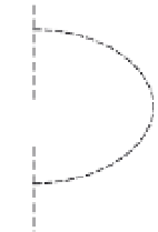
Sun
The drift correction compensates for drift in the instru-
ment
Attraction of
celestial bodies
Earth
s reading over time (see
Section 3.3.1
)
. The drift
correction is based on repeat readings at the base station
(s). By recording the time of each reading, the drift rate can
be determined and the effect removed from each gravity
measurement. The assumption is made that the drift is
linear during the time between base station readings.
'
Moon
>
R
Equator
<
R
Equator
R
Pole
Decreased
gravity
Increased
gravity
3.4.4
Variations in gravity due to the Earth's
rotation and shape
b)
The Earth
is gravity
field is stronger at the poles than at the
equator by about 51,000 gu as a result of several effects. The
Earth
'
Toronto
s rotation produces a centrifugal acceleration directed
outwards and perpendicular to its axis and is strongest at the
equator. As a result the Earth
'
1 gu
is shape is roughly ellipsoidal
the polar radius (R
pole
). As a consequence, the Earth
'
Perth
'
s surface
gets progressively closer to its centre of mass at higher
latitudes. This proximity effect is greater than the attraction
at the equator from the extra mass between the surface and
the centre due to the larger equatorial radius, as expected
acceleration due to gravity, so gravity is less at the equator
(
Fig. 3.14a
). At progressively higher latitudes, the centrifugal
acceleration decreases and becomes increasingly oblique to
the direction of gravity. It is zero at the poles.
The surface of equal gravitational potential (see
Section
It is an undulating surface mainly in
uenced by variations in
the distribution of mass deep within the Earth. It de
nes the
horizontal everywhere and is an important surface for
surveying. Numerous global and local geoids have been com-
The direction of a suspended plumb line is the direction
directed downwards towards the Earth
1st June
2nd June
3rd June
4th June
Day (2005)
Figure 3.13
Earth tides. (a) Schematic illustration of the gravitational
effects of the Sun and the Moon on gravity measurements on the
Earth
s surface. (b) Earth tides at Toronto (northern hemisphere)
and Perth (southern hemisphere) over a 4-day period in June 2005.
Note the approximate 12-hour periodicity.
'
that of the Sun. Even though the Moon has far less mass
than the Sun, its closer proximity to the Earth means it
attraction of extraterrestrial bodies has two components:
the actual attraction of the bodies, and the distortions
they cause to the Earth
s shape known as solid Earth tides
(
Fig. 3.13a
). The latter lead to changes in the Earth
'
s
radius of a few centimetres, and produce changes in the
distance and mass between an observation point and the
Earth
'
s centre of mass. They are collectively referred to as
tidal effects and produce gravitational changes of less than
3 gu. The effect varies with time and latitude owing to
variations in the positions of the Moon and the Sun. It
has a period of about 12 hours (
Fig. 3.13b
)
and is greatest
at low latitudes.
The variation in gravity due to the tidal effect can be
accurately calculated for any time at any location on the
Earth using the method of Longman (
1959
). Modern
computer-based gravity meters automatically calculate
and apply the tidal correction to the measured gravity.
'
'
s centre of mass
and is perpendicular to the geoid. It de
nes the vertical
(see
Fig. 3.15a
).
The undulating geoid is not a convenient surface to
represent
the Earth for geodetic purposes.
Instead a
smooth ellipsoid is used that is a
to the geoid (Li
also referred to as the reference spheroid, and is the ideal-
ised geometric figure to which all geographical locations
are referenced in terms of their geographic coordinates,
'
best-t
'


Search WWH ::

Custom Search