Geoscience Reference
In-Depth Information
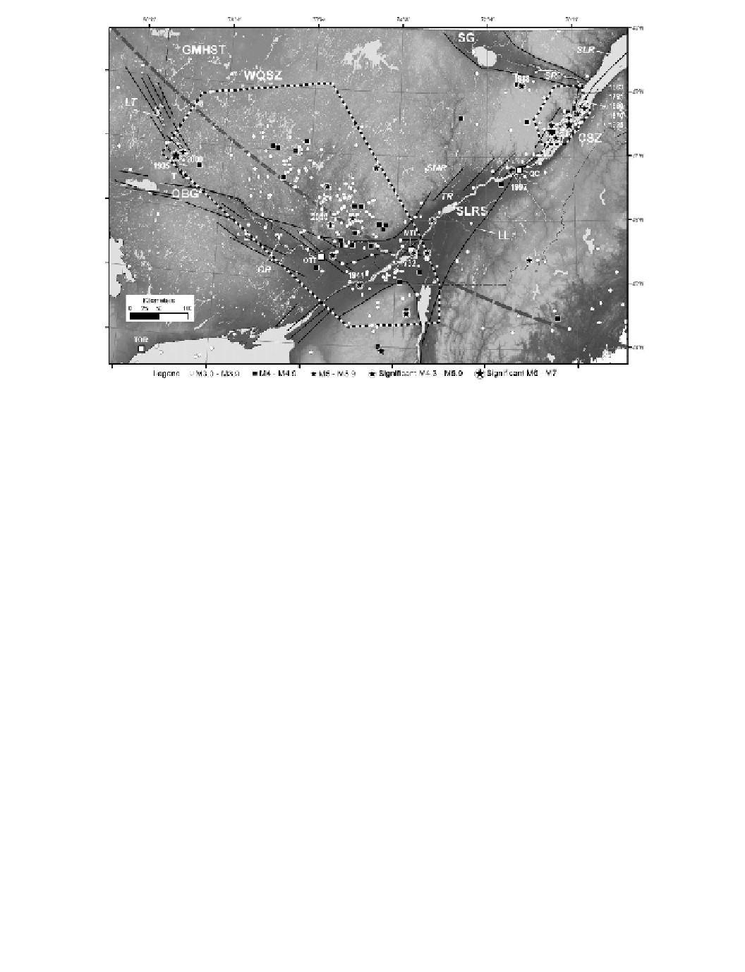
Figure 4.2 Seismicity of the SLRS in southern Quebec and eastern Ontario. Earthquakes of magnitude
larger than 3.0 recorded between 1980 and 2012 inclusively together with significant earthquakes of
Eastern Canada are shown (listed in
Table 4.1
;
Lamontagne
et al
.,
2008a
)
. Seismic zones are: WQSZ
Other acronyms are: GMHST, Great Meteor HotSpot Track (assumed); OBG, Ottawa-Bonnechere
Graben; SG, Saguenay Graben; LL, Logan's Line. Place names are: TOR, Toronto; OTT, Ottawa;
MTL, Montreal; QC, Quebec City; TR, Trois-Rivieres; T, Temiscaming. Rivers and lakes mentioned
in the text are: LT, Lake Temiscaming; OR, Ottawa River; SMR, Saint-Maurice River; SR, Saguenay
River; SLR, St. Lawrence River. For colour version, see Plates section.
earthquake. Its effects included liquefaction and rock falls in the epicentral region and land-
slides as far as 200 km from the epicentre. At 30 km from the epicentre, for example,
There, evidence of older liquefaction and ground failure was found, possibly caused by
away from the epicentre where failures of railroad embankments were reported (Mitchell
earthquake recorded by strong ground motion instruments and showed the high-frequency
SLRS is especially at risk where marine clays are found, because even moderate earth-
quakes can trigger earth flows. In 2010, for example, the
M
5.0 Val-des-Bois earthquake