Geoscience Reference
In-Depth Information
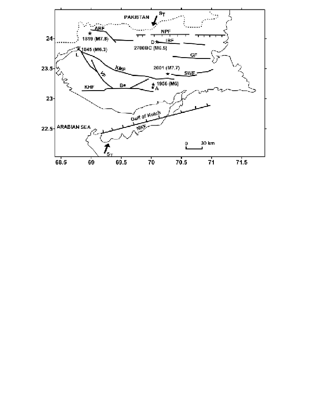
Figure 11.4 The Kutch Rift Basin lies between the Nagar Parkar and North Kathiawar faults (NPF
and NKF). Historical earthquakes in 1819, 1845, and 2700 BC are inferred to be associated with the
Allah Bund, Kutch Mainland and Island Belt faults (ABF, KMF, and IBF) respectively. Instrumentally
located 1956 Anjar (A) and 2001 Bhuj (B) earthquakes were associated with the Katrol Hill (?) and
South Wagad faults (KHF and SWF) respectively. D and L show the locations of old historical towns
at Dholavira and Lakhpat. S
T
shows the direction of the regional S
Hmax
. (Fault map courtesy B. K.
Rastogi.)
one or more LSCs, and the release of this accumulated stress can occur sequentially. For
example, within the Kutch Rift Basin destructive earthquakes have occurred on different
faults (
Figure 11.4
)
. The 1819 M 7.8 earthquake occurred on the northern Allah Bund
fault, the 1845 M 6.3 earthquake that destroyed Lakhpat on the Kutch Mainland fault, the
1956 M 6 Anjar earthquake on the Katrol Hill fault (?) and the 2001 M 7.7 Bhuj earthquake
on the North Wagad fault (Rastogi
et al
., this volume). Based on paleo-archeological data
and historical reports of the destruction of Dholavira, the 2700 BC earthquake (estimated
earthquakes on any one of these faults possibly explains the absence of major topographic
features associated with repeat earthquakes within the same rift.
Within the Reelfoot Rift in the Central United States, there is paleoseismic evidence
of two large earthquakes hundreds of kilometers away from the NMSZ. These occurred
5,500 yrs BP in eastern
2,000-year record of historical seismicity in