Geoscience Reference
In-Depth Information
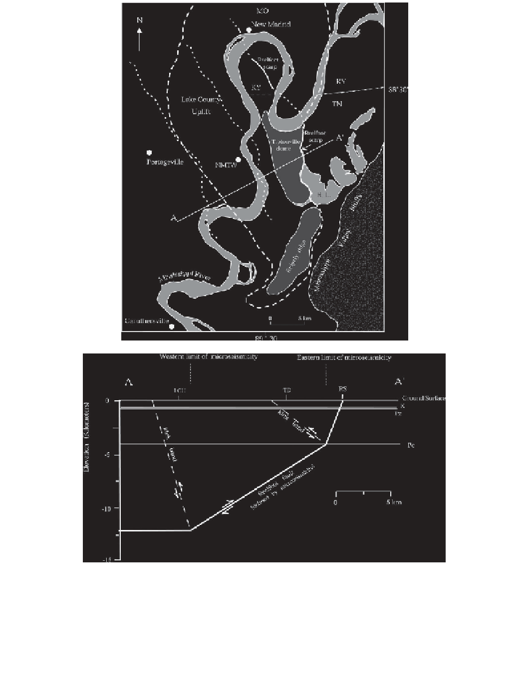
(b)
line marks the boundary of the Lake County uplift as defined by Russ
(
1982
)
, and the dotted lines are
kink bands (back thrusts) on the west side of the Tiptonville dome and Lake County uplift. Line A-A
is the line of cross-section in B. RL, Reelfoot Lake. (b) Cross-section A-A
with its kink bands (back
thrusts). K, top of Cretaceous; Pz, top of Paleozoic; Pc, top of Precambrian; LCU, Lake County uplift
western margin; TD, Tiptonville dome western margin; RS, Reelfoot scarp. No vertical exaggeration.
Reverse fault displacement not visible at this scale.