Geoscience Reference
In-Depth Information
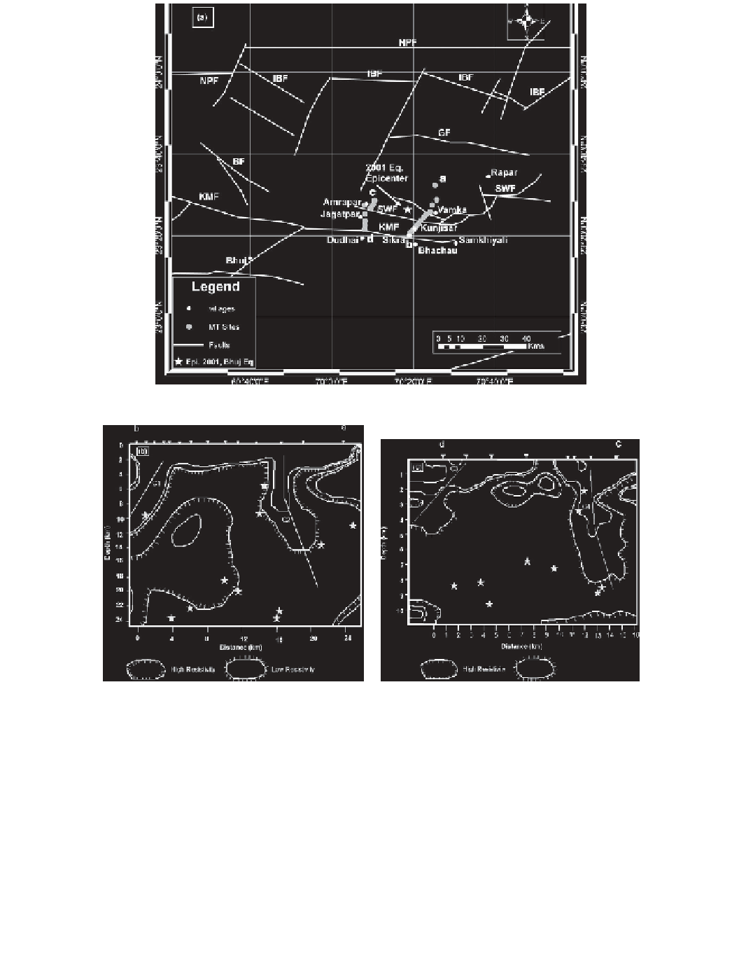
(a)
(b)
(c)
Figure 6.4 (a) Locations of MT profiles AB and CD on Geology and Tectonic setting of the area (after
Biswas,
2005
)
. Profiles are east and west of the epicenter of the 2001 Bhuj earthquake (23° 26.4
N
70° 18.6
E (ISC), which is shown as a star 15 km northwest of Bhachau. (Epicenter by USGS is 9
km WSW.) (b) 2D geoelectric depth section (eastern profile) down to 24 km. The conductive block
towards the “b” side is the Kachchh Mainland Block and the conductive block towards the “a” side
(around 16 km distance) is the Wagad Block. M
4 hypocenters from 2006 to 2012 are plotted: C1,
KMF; C2, SWF. (c) 2D western geoelectric depth section to 14 km depth. Epicenters of M
4 from
2006 to 2012 are plotted: C3, KMF; C4, SWF. Low resistivity zones indicate faults.